Well almost Pamlico. We are at Oriental North Carolina which is on the Neuse River at the south end of Pamlico Sound.
We left Bald Head Island on Friday morning after being there a week. We had a great time going to the beach, climbing the light house and just hanging around the marina. We met two couples that also own Island Packet yachts. Both were from Canada. They had been in the Bahamas and were heading home to Nova Scotia. We all got together for happy hour on Tuesday evening, had drinks and hors d'œuvres. We all told of our sailing tales and laughed at them all. It is amazing how many other couples have very similar experiences as we do. I had mentioned my taking evasive action from the moon rising. One of the ladies said she was trying to hail the planet Mars on the VHF radio. She though it was another sailboat that had come close by. As one other sailor we met says, "There is some weird S#@t that goes on our there at night".
From Bald Head Island we went north to Wrightsville Beach. It was only 28 miles so it was a short day. There were a couple of tricky areas on the ICW with lot's of current that made my adrenaline flow. We stayed at the Wrightsville Beach marina for the night. On Saturday we arose early in order to get through the Wrightsville Beach bascule bridge. The bridge only opens on the hour from 7AM to 7PM. We asked for an opening at 6:30 AM and were on our way to Swansboro N.C. This was a long day covering 54 miles. We had 3 other bridges to get through also. One of them only opens on the hour and we arrived just 10 minutes past so we had to hang out for 50 minutes before we could get through. We had quite a bit of current against us in the morning. Once we past Brown's inlet we had the current going with us and saw speeds up to 8.5 knots. This helped get us to Swansboro by 4:00PM. We were pretty tired so we ate leftover spaghetti and went to bed. On Sunday we knew that there was some bad weather moving into the area and had 48 miles to cover to get to Oriental. We again departed at 6:30 AM. There were no bridges to wait for on this leg. We had the current going with us the entire way from Swansboro to Morehead City. At one point just before the Beaufort inlet we saw 9 knots. Once past the inlet we slowed to 4.8 knots. What a let down but we knew it was coming. The rest of the trip up to Oriental was pretty boring. The route wound it's way through Adams Creek to the Neuse River. There were thunderstorms to our south that were building. We could here the thunder. I checked the weather radar and they were moving to the northeast away from us which was a relief. I could see additional rain moving our direction from New Bern to the west. I was hoping to get to the Whittaker Pointe Marina before the rain reached us. It was a close race. It started to rain just as we were pulling into a slip.
There is some really bad weather heading our way and should be here Tuesday thru Thursday. One forecast says there could be winds up to 65 knots. More likely 30-35 though. I think we will stayed tied to the dock until it passes by. We will leave sometime late in the week and continue north. Our destination is Hampton Virginia where we will take a slip for a couple of months. We plan to explore the Chesapeake Bay from there.
Once in Hampton I am going to fly to Mobile Alabama and pick up our Expedition and bring it up to Hampton so we will have ground transportation. There are lot's of nice land trips we can do in that area.
Sunday, May 23, 2010
Sunday, May 16, 2010
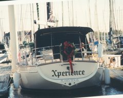
Resting at Bald Head
We made it to Bald Head Island after a 28 hour sail from Charleston. The winds were lighter than forecast which really hurt our speed. However the seas were very calm which made for a pleasant sail. We had every sail configuration you can imagine trying to get power from the wind. Once we were tied up to the dock we both fell sound asleep for about 3 hours. We slept another 11 hours that night. With only two of us on the boat it is difficult to get a long sleep while underway. I had only slept 3 hours in the previous 32 hour period.
When we left Charleston Harbor going out the inlet I saw a Valiant 42 coming in that looked awfully familiar. Sandy looked through the binoculars and sure enough it was Savage Son sailed by Bob and Bev. They were dock neighbors of ours at Lake Texoma. Their boat left Texoma on a truck the day before ours did. They trucked their boat to a marina near Jacksonville Florida and left for the Bahamas in December. With such a huge ocean the odds of meeting up like that are unfathomable.
We are staying at the Bald Head Island marina for a week. When I checked in with the harbormaster I took off my hat and said "I believe I qualify for a discount". His response was "Cute". I didn't get the discount. They call this island the Nantucket of North Carolina because the homes all look like New England style homes. About 95% of the homes are vacation rental homes. People have to come by either private boat or ferry. Also there are no private cars on the island. Everyone uses golf carts. There are miles of Sandy beaches and a beautiful golf course.
So far we have walked on the beach, which is very wide and about 17 miles long. We didn't walk the entire length. We went to the Old Baldy light house and climbed to the top and we rented a golf cart and drove around to see the island and pick up some groceries. And of course we are doing the one thing that all cruisers do when they go into a marina - laundry. Usually the laundry room is the center of socializing. Not here though. The marina is small and there are not very many cruising boats here. This marina is not on the ICW. If the boat didn't come in the Cape Fear inlet they probably would not stop here. However there is one boat here that we had seen at several stops in Florida and also at Beaufort South Carolina.
Our next move will be up the ICW. We will stop in Oriental which is claimed to be the sailing capital of North Carolina. It has 700 residents and 3000 boats. Oriental is about 125 miles from here so it will take us about 4 days or so.
Wednesday, May 12, 2010
Visiting Charleston
We departed Beaufort S.C. on Monday. We left a little after 9:00 AM and went to the fuel dock to refuel. We had to wait until 10:00 AM for the next swing bridge opening to head up the ICW. Prior to leaving I had talked to several local boaters from around the area and also the TowBoatUS operator about any shoaling we might encounter. They all said the ICW is passable at low tide the entire way. Well they were wrong. Yep, you guessed right how we found out. All was well until we got to our first cut. The ICW in South Carolina between Beaufort and Charleston goes up and down rivers. There are several cuts or canals between the rivers to pass between them. The first one we came to was the Ashepoo-Coosaw cut. This takes you from the Ashepoo river over into the Coosaw river. Except we were going the other way so we went from the Coosaw to the Ashepoo. We just happen to arrive at the cut entrance just after low tide. Several large motor trawlers had passed through before us. Well we hit bottom at a depth of about 4 and a half feet. We draw around 5 feet. There was a large sailing catamaran behind us and he passed us on our starboard side and went through. Obviously they draw less than us. Another sailboat behind us saw us stick in the mud and made a quick U-turn. Once the catamaran was out of the way we were able to back off the bank. The other sailboat, Calypso, and us talked on the radio and made a plan to wait about 30 minutes for the tide to come back in. We both just circled around together. When another large trawler came by, Life's 2 Short, they went through and radioed to us that they saw 7 feet on their depth sounder. We then continued on our way.
That evening we anchored in the South Edisto river around ICW mile marker 504. There wasn't much protection from the wind and there was about 1.5 knots of current. The current causes waves to slap the bow which makes for a noisy night. All together there were 4 boats anchored here. Three sailboats and a trawler.
On Tuesday morning all of the sail boats left about the same time. We were last leaving at 6:45 AM. The next challange we had was another cut called Elliot's cut which goes into the Wappoo Creek. The Wappoo creek is a short stretch between the Stono river and the Ashley river. The Ashley river is on the west side of Charleston. Elliot's cut is very narrow and the current can really flow fast. When we went through we had a current of 4 knots running with us. I barely had any RPM on the engine and we were doing over 8.5 knots. Once through the cut it was just a short distance to get into Charleston where we are staying at the City Marina.
Tomorrow we are leaving here and heading back out into the ocean. We have a good weather window for the next 3 days with winds forecast to be southwest 10-15 knots and seas 2-3 and 2-4 feet. We will head northeast and reenter the ICW at Cape Fear and the Cape Fear river. We have a reservation at the Bald Head Island Marina which is not even all the way up the Cape Fear inlet. Since I resemble the name of the marina I'm thinking about asking for a discount.
Saturday, May 8, 2010
Movin' On
We stayed in St. Augustine for a week. This is a great city if you like history, which we do. The city is the oldest continuous settlement in the U.S. While we were there a friend of mine from High School visited. I hadn't seen her in 39 years and we had a great visit. We had communicated through email for a couple of years so when we finally met again it was very relaxed.
We departed a half hour late because of fog. The first thing we had to do was go through the Bridge of Lions and we could hardly see it even though we were in a slip 100 feet away. The bridge only opens on the hour and half hour so we waited. The fog lifted enough by 7:30 for us to get out of the slip and go through. We continued north up the ICW to Fernandina Beach Florida. This will be the last stop in Florida. Just a couple of miles north is the Georgia border. We decided not to do the ICW in Georgia because we had heard that they had not dredged the ICW for at least three years and it has lots of shoaling areas. One boater told us when he came south he went aground twice and bumped bottom many times. And this was with a shallower draft then ours.
We stayed on a mooring just one night in Fernandina Beach because we had a good weather window to go out the St. Mary's inlet for an overnight sail to Port Royal Sound. We left the mooring around 11:15 AM and went over to the fuel dock to refuel for the trip. We left the fuel dock right at noon and headed out. The inlet channel is about 8 mile long so when you finally get out you can hardly see the low lying Amelia and Cumberland Islands that make up the south and north land masses of the inlet. On the way out we saw lots of dolphins and leaping rays. That's right, leaping rays. There were sting rays leaping out of the water. That was a first for us. I had said to Sandy, "Now ya don't see that sitting at home in your living room".
The wind and seas were pretty calm when we finally got out and made our turn northeast. Wind was about 8-10 knots from the southeast and seas around 1 foot. A very comfortable ride. We were moving about 5-5.5 knots. We had planned for an arrival at the Port Royal Sound outer buoy around 7:30-8:00 the next morning. I wanted to enter during daylight. Sometimes they move the entrance buoys from what is on the chart depending on where the current shoaling is.
As the night progressed the wind was forcast to turn to the southwest and freshen to 10-15 knots. The forcasters were right on with this one. Around 8 PM the wind slowed some and by midnight had clocked around to southwest and picked up speed. Unfortunately so did the seas. The waves became 2-3 feet.
During the night we had heard several distress calls to the coast guard. One was a fire onboard a boat. The boat was in one of the sounds and they were able to get the fire out while another boater came to their aide. Another was an overturned boat about 100 mile southeast of Charleston. When you hear those you thank god it isn't yourself that is having an emergency.
We had to cross the entry channel to Tybee Roads which goes into the Savannah River. It was still dark but I could see several objects on radar right in our course path. There was no moon and it was really dark. I first picked up the objects on radar about 16 miles away. As we approached we could make out that they were anchored ships waiting to go into that channel. We slowed down some since it was getting close to 6 AM when there is a little daylight. Once we could clearly see a path through the anchored ships we continued.
We arrived at the Port Royal Sound buoy at 7:55 AM with winds around 20 knots and seas 2-4 feet. With lots of 4's. The current and wind was pushing us east and when entering the channel we had to have a 20 degree crab to the west of course to stay between the buoys. From the outer buoy it is about 28 miles to reach Beaufort S. C. We arrived right at noon and tied up at the Downtown Marina. It was exactly 24 hours and we were tired. We were not able to get much sleep with the seas so lumpy. 2-4 foot waves are not bad except the period between the waves was very short and the direction was confused, meaning they came from several different directions.
We are going to visit here for a couple of days and then head up the ICW to Charleston.
Well, it's Saturday night and you know what they say about sailors. A sailor likes his rum like a diesel likes its oil.
Friday, April 30, 2010
Never a dull moment!
I forgot to mention an incident that happened enroute between Vero Beach and Cocoa. Either I was to tired when we arrived at St. Augustine or just overjoyed to be at a dock.
About an hour from anchoring at Cocoa one of our monitor alarms went off. We have an alarm for high water, explosive fumes and fire in the engine room. I could hear the alarm from the cockpit and figured it was the fumes alarm which is very sensitive and sometimes goes off if there is a buildup of fumes from the diesel. If that happens I just vent the bilge and it goes off. When I came down below and looked at the monitor it was the engine room fire alarm sounding. Talk about something that will age you 10 years in a heartbeat. I immediately looked through the little access hole into the engine room, this is where you would blast the fire extinguisher into, to see if there were flames or smoke. There were neither. The alarm goes off based on heat. I opened the port engine room door and it was hot in there. I could see that one of the connections on the back of the alternator was sparking and the rubber cover had melted on the top. Also I checked the battery monitor and it showed that the alternator was charging at over 15 volts. It should have been under 14.3 and more like 13.25 since we had been motoring for awhile. I felt the batteries and they were still cool. We lowered the RPM on the engine and I vented the engine room to try to keep it cooler. Once we arrived at Cocoa and anchored I telephoned the Balmar company to get some assistance. I talked to Rick Jones who I had known to have assisted other Island Packet owners in the past. He walked me through how to do some tests to try to determine if the problem was with the alternator or the regulator. We determined it was the alternator so I started checking it out. I was checking the wiring and connections to it. I found one connection that was a little loose but not significantly. The connection that was sparking looked as though it had some corrosion on it so I disconnected the four wires from it and sure enough all of them had some corrosion. The corrosion makes for a very bad connection and the output electricity didn't have anyplace to go. I used sandpaper to clean them off with a little WD40 to break up the rust. Once cleaned I put it all back together and ran some tests checking for proper output to the batteries. Everything looked good, no sparking and the proper charging. The next day on the way to our next anchorage I checked it about every half hour to make sure all was well. So, lesson learned, keep your connections clean.
Each day when we start out I say to Sandy, "What challenges will we face today?" Her response, "If you don't say that maybe we won't have any". Yeah right, this is a boat. Bring On Another Thousand!!
Thursday, April 29, 2010
Now in St. Augustine
We departed Vero Beach, some cruisers call it Velcro Beach because it is hard to leave, on Tuesday. We didn't have any problem getting out into the ICW channel. We were planning on stopping at Melbourne but had some good current with us so we went all the way to Cocoa. The anchorage there was large and there were plenty of boats that stayed there for the night. The wind was really blowing but our trusty SuperMax anchor held us in place.
On Wednesday we had planned to stop at Daytona Beach but we didn't like the anchorage and the decided to go on to New Smyrna Beach. When we passed by the area on the ICW where the Ponce inlet is there was a lot of shoaling and we scraped bottom in just 4 feet 9 inches of water. Our boat draws about 4 feet 10 inches. Cruisers just call that dense water and plow through. We were able to get through it and into deeper water OK. We stopped for the night in a small creek named Rockhouse Creek just to the north of New Smyrna Beach. There were already 5 boats in the small anchorage and 3 more came in after us. The anchorage was very quiet and we had a beautiful sunset. We also had about 5 dolphins frolicking around the boat. Two of them looked as if they were putting on a show for us, jumping out of the water together and slapping their tails.
We were up at 6AM preparing to leave for St. Augustine. We raised anchor at 7:15 and departed. We had several bascule bridges that we had to have open for us on this leg. One particular bridge was having work done on it and we had to wait for about 3o minutes. The area to loiter was very small and it got shallow real fast as you got near shore. Two other sailboats came up behind us and that made things even crazier with all three of us waiting. Just past this bridge we saw 3 manatees. The only other manatees we had seen was the previous day in a small cove off of Haulover canal.
We had thought about anchoring in the Matanzas River where there is an old fort to visit but that area was terribly shoaled in. There were several new green buoys set out to guide us around the shoaling. The markers took us to about 100 feet from the western shore. The depth got down to about 5 feet 6 inches in the area we went over. It may have been a little deeper closer to shore but it was difficult wanting to go that close. Once we passed the Matanzas inlet we had a 1.5 knot current pushing us north. We were doing about 8.5 knots. We covered the last 15 miles to St. Augustine in less than 2 hours. Earlier in the day we had a 1.2 knot current against us and were only able to go 5.8 knots.
We are in a slip at the St. Augustine Municipal Marina and will be staying for a few days. There is so much history here and things to do. St. Augustine is the oldest permanently inhabited city in the U. S.
Sunday, April 25, 2010
More experiences
We arrived in North Lake Worth around 6 PM on Tuesday. The anchorage is very large and open so we didn't have any problem finding a place to anchor. On Wednesday we were able to dinghy into a spot up a small creek by a bridge with a small beach to land the dinghy. Once up on the road it was a short walk to the Publix grocery store and some other shops in a strip mall. The anchorage was so nice we decided to stay for a few nights.
We left North Lake Worth on Friday and headed for Vero Beach. We didn't have as many bridges to contend with so our progress was pretty good. There were 4 bridges that opened on a schedule and 4 that opened on demand. We were averaging around 7 knots most of the way. At times we would be down to 5 or up to 8 depending on the current coming in or going out at the different inlets we would pass. We stopped overnight in Ft. Pierce and anchored to the south of Causeway Island. The wind was from the south and the anchorage was open so it was kind of choppy until the sun went down and the wind died down. There were about 7 other boats anchored there also.
On Saturday we awoke at 6 AM and prepared to make the run the final 17 miles to Vero Beach. This part of the ICW is made up of the Indian River and is quite wide, however the ICW channel is only about 100 feet wide at most points. In the channel the depths are anywhere from 9-16 feet. Just outside the channel the depths can be 4 feet or less. Our draft is around 5 feet so we definitely have to stay in the channel. There were lots of local power boats out and it seemed that they were racing to the Ft. Pierce inlet to see who could get out to catch the first fish. Only a few would slow down when they pass. The others go by with big wakes that cause us slow sailboats to rock and roll with the wakes.
We arrived at Vero Beach in about 2 1/2 hours. To get into the marina you have to go under a 65 foot bridge and then immediately turn into the marina channel. Right as we went under the bridge my Garmin chartplotter gave me an error message about losing satellite connection. That and a marina welcome sign diverted my attention from the channel and the south wind and current swept me right into the shoaling. Yep, hard aground. We tried for about 20 minutes to try and back off with no luck. I called TowBoatUS to come pull us off. They were there in about 30 minutes and pulled us right out of the mud. The TowBoatUS guy told us that if we would have grounded about 50 feet further to the east we would have been on some rocks instead of in the mud. Once in the marina we picked up a mooring and had a drink. Later when I was talking to the marina staff they told me that they call that corner Gold Mine Corner. I guess we weren't the first or be the last to ground there. And to top off all of that we were boarded by the Florida State Fish and Game officers to check our sewer system to make sure we aren't pumping anything overboard. I am actually surprised it took this long for us to get boarded. We have been in Florida waters for almost two months now.
Today we walked to the actual Beach. It is a very long beautiful sand beach. Not crowded at all. It was a vero pretty beach
We are staying here until Tuesday when we will leave to head further north.
Sunday, April 18, 2010
Stay on the path boss there's gorillas in the woods!
You captain Ron fans will remember that line. Well, there aren't any gorillas or guerrillas that I know of anyway but there are some big freakin' lizards in the trees. No Name harbor is located in the Bill Baggs state park. When we walk to the grocery store we take a path thru the woods. These big iguanas hang in the trees and scurry around on the ground. Just makes you shiver.
We took a walk over to the park beach. It is listed in the guidebook as one of the United States top 10 beaches. If this beach is one of the top 10 this country is in big trouble. There was litter everywhere. The sand was mixed with tons of plastic bits from plastic cups, plastic utensils and just a lot of junk. We couldn't walk on it in our bare feet because it hurt and we were afraid of cutting ourselves. Very sad.
Well, we finally left No Name harbor and sailed 31 miles north to the Port Everglades inlet. That is located at Fort Lauderdale. The winds were east to southeast from 13-21 knots. It started out very rough with seas in the 3-5 feet range and them came down to the 2-4 range. Very uncomfortable but not dangerous. The seas were mostly from the starboard side to the starboard aft quarter. At one point a rouge wave hit us on the starboard side and sent water crashing into the cockpit. It was a lucky thing that I had the enclosure panel down that was right next to the helm or I would have gotten soaked. The Port Everglades inlet was extremely rough with confused seas. Sandy was the helms person on the way in and she had a very difficult time keeping the boat on a straight course. Being a Saturday there was a lot of local boat traffic and the wakes from them make things worse. Once inside the ICW was calm and we had to wait for a bascule bridge to open for us to go north on the ICW and into Lake Sylvia. We are staying here today, Sunday, and will head out for Palm Beach and Lake Worth on Monday. We will most likely take the ICW because the weather is still crappy. The bad thing about doing the ICW from here to there is that there are 20 bascule bridges we have to have opened for us. They open on a schedule but you have to be there at the right time or wait up to 30 minutes. Once past Palm Beach the number of bridges is drastically reduced.
Thursday, April 15, 2010
Still in No Name Harbor
The weather has been terrible this past week. It has poured rain and the wind has been in the upper 20's with gusts in the 30's. We had planned to leave this past Monday and started out. The weather forecast for that day had looked pretty good but it wasn't as forecast when we got out into the ocean. We saw lightning and the wind was 25 right in our faces. After getting our butts kicked by 5-7 foot waves we retreated back into No Name. There is no shame in retreating. It is now looking like we will be able to leave this Saturday.
During the week this place is a serene little anchorage. On the weekends it is party harbor with a whole lot of million dollar power boats coming in. Loud music and lots of noise. I have never seen so many blond Cuban woman in all my life.
Here are a couple of photos of the harbor during the week. There are 13 sailboats here and one power trawler. Most of the boats are waiting ot go north. At least one is waiting to cross to the Bahamas. They have been waiting for a couple of weeks now. This same boat was in Marathon when we were. A couple of the other boats were in Marathon too and have been here since we got here.


Friday, April 9, 2010
Heading North
Well, East first, but you get the idea. We left Marathon and Boot Key Harbor on Thursday. We left at 7:15 AM so we could arrive at Rodriquez Key while it was still daylight. The wind was blowing from the southeast between 20 and 25 knots with the seas running about 5-7 feet. We had to motor right into the seas to get out of the harbor and around some shoaling and into Hawke Channel. Since we hadn't been out for three weeks we did get a little queasy but not to the throwing up point. It wind was forecast to ease by midday and it did. By the time we were passing 5 mile bridge the wind was down to 15 and the seas were about 3 feet. That are is also more protected by the reef to the south. We had a nice sail with full sail from that point to Rodriquez key. we traveled 54 miles.
We woke early Friday morning and headed out for Key Biscayne and No Name Harbor. There were several other boats anchored at Rodriquez also. It seemed everyone left at the same time and it was like a convoy going north. The winds had started out from the southeast around 15 and then shifted to the south around 8. The first part was a good sail but after the winds shifted we were doing some more rocky-rolly. We motored for awhile and arrived at No Name Harbor around 3:00. We traveled 44 miles. During the trip we saw about 50 huge power yachts and big open fishing yachts heading south. It must have been the exitice from Miami. Don't know where everyone was going but they were probable going about 30 knots so they could make it all the way to Key West in about 5 hours. They would blow right between several of the sail boats and we would all go rocking. They didn't care.
Not sure why they call this place No Name Harbor. For having no name it sure is crowded. I see a couple of boats that were in Marathon but rest may be Miami weekenders. There is barely enough room to swing and the wind is going to shift tonight. Should get interesting.
Subscribe to:
Posts (Atom)