Kilo Foxtrot Five Mike Mike Bravo
This is my new HAM radio call sign. I have been studying this summer to get my HAM radio license. I passed the technician test in August and passed the general test in September. I added a Pactor modem to our onboard SSB, Single Side Band, radio so we can now send and receive emails over the HF, high frequency, airwaves and also download more and better weather data. With the HAM license I can use frequencies that will allow me to do this anywhere in the world.
Saturday, September 17, 2011
Tuesday, August 30, 2011
Hurricane Irene
We weathered the storm at Northwest Creek marina. It is just down the Neuse river from New Bern North Carolina. The marina has a good hurricane plan, that is one reason we decided to spend the summer here.
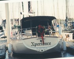
Xperience had no damage to her. Some boats had minor cosmetic damage and there was some minor dock damage. The biggest headache will be all the cleanup. We drove around the area and there are dozens of trees down just in this neighborhood. Some are on top of homes. Some area have there power back on but not the marina. We most likely won't have power for another 3-4 days. We moved back onto the boat on Sunday. Here we can cook with our propane stove and we have solar panels that can keep our batteries charged to run the refrigeration, lights and pumps. There is fresh water on the docks.
Here is a link to photos taken prior to, during and after the storm.
 |
| Hurricane Irene 08/27/2011 |
Friday, June 17, 2011
Just Hangin'
We are just hanging around and doing some boat work at Northwest Creek marina near New Bern, North Carolina.
We were able to get four coats of Cetol on our exterior teak. We cleaned it up real good and put two coats of Cetol Natural Teak which has a little bit of color in it, and also two coats of the Cetol clear gloss. You wouldn't believe how the salt water corrodes the stainless steel. We used Collinite metal wax to go over all of our stainless steel to bring it back to its shiny glory. It took lots of rags and a couple of toothbrushes to get into all of the little nooks and crannies.
We have met many nice people that have there boats in slips next to us. Some we knew from the Bahamas. There are about 6 couples staying here that we met in the Exumas. A few of them have homes nearby.
We rented a car and drove up to Hampton to pick up our Expedition. It is good to have ground transportation. We have gone around the city of New Bern and are learning where things are, especially the good restaurants. Eventually we will travel out a little further. Next week we plan on going up to Raleigh. It is about a two hour drive from here.
We have several more boat projects to do and we need some more spare parts for the next cruising season so we will be working on that stuff. There is always something to do on the boat.
Thursday, April 28, 2011
Now in North Carolina
We departed Fernandina, Florida on Wednesday the 13th of April. We had a good weather window for about 66 hours and it would take us about 50 hours to reach the Southport marina. We knew we could duck into either Charleston or Georgetown if need be.
When we were going out the St. Mary's inlet we saw "Margareta" IP445 with Bill and Margaret heading out also. We met them at Long Island in the Bahamas in January. They are from North Carolina and keep there boat at Northwest Creek Marina. I hailed them on the radio and Bill told me they were going to go in at Charleston. We decided to set up radio contact every three hours for the overnight passage.
Margareta stayed closer to shore and we did the rhumb line route so we were about 20 miles further out to sea. During the night Margareta kept getting further ahead of us. Bill said that they had a two knot current helping with their speed. The first night passage was relatively mild and we had to motor sail most of the way. Margareta passed the Charleston inlet around 6 AM so they decided to continue further up to Georgetown. We passed the inlet around 9 AM. We were right on our scheduled time. We didn't want to get up to the Cape Fear river before daylight the next morning.
The second night out the seas got really sloppy for about 6 hours and it cut our speed way down. We had 2-3 foot waves on the bow. I had checked the weather forecast and it showed that the wind and waves were supposed to back to the southeast later in the day. Sure enough it did and we were back up to our cruising speed with an estimated time to arrive at the Cape Fear river at 5 AM. Sunrise was at 6:48 AM that day so we had to heave to for about an hour and a half to wait for it to get light enough to see the channel buoys. The current was to be slack at 6:58 AM and then start ebbing which would be against. I wanted to get into the inlet as soon as we could. As it turned out the speed of the ebb was faster than us. By the time we got just past Bald Head Island we had a two knot current against us. Also the wind had picked up out of the southest to 15-20 knots.
We were able to reserve a slip at the Southport Marina for a few days. There was some really bad weather with predicted tornadoes heading our way. It did arrive on Saturday night and was as bad as they predicted.
We left Southport on Monday and just went up to Wrightsville Beach. We had a great current going with us and the 27 mile trip only took us a little over 3 hours. We stayed in Wrightsville Beach one night. We left at 6:30AM with a good current and was able to time it so we made all four of the bridge openings between Wrightsville Beach and Swansboro at our planned time. We stayed at Swansboro for one night. Margareta had caught up to us and were tied up at Caspers Marina next to us that night. The next morning we left Swansboro at 6:45 AM and made it up to Whitaker Pointe Marina by 1:30 PM. We stayed there for six nights until we could get in at Deaton's Boat Yard for service. We will stay here until the service items are taken care of and then head up the Neuse River to the Northwest Creek Marina. We will be staying there for an extended period of time. We are going to go up to Hampton, VA to pick up our Expedition and bring it back so we will have ground transportation.
All in all it was a good sailing winter. We saw and experienced a lot of new things and met some wonderful people. It is going to be nice to just sit still for awhile though. I am looking forward to sleeping in and not having to get up at 6:00 AM to listen to the weather every morning. Hey, maybe I will stay up past 9:00 PM now.
Wednesday, April 6, 2011
Moving north
While at Vero Beach we rented a car and went to Walmart to restock. We also went to the Publix grocery store to get fresh meat and produce. Every Saturday there is a farmers market over by the beach. We went over and bought some grapefruit and oranges and they are excellent.
After being at Vero for a couple of days "Song of Pogo" came in. This is the sailboat with Otis and Marty from Annapolis. We met them last year at the Dismal Swamp Canal visitors center and had been in anchorages and marinas with them all the way to Vero Beach on our way south. They had crossed over to the Bahamas on the same night we did in December. They went and stayed in the Abacos while we went further south. We also ran into "My Time Two" with Charlie onboard. We last saw him at Vero in December. He went to Ft. Myers on the west side of Florida for the winter.
We stayed at Vero Beach for eight nights and then left with "Song of Pogo" heading north. The first night we anchored overnight off the ICW at Eau Gallie. The next morning we left and went up to Titusville. "Song of Pogo" is going to stay at the Titusville marina for a month while Otis and Marty go care for his 91 year old father. We stayed for four nights at the marina to allow a really strong line of storms pass over. One night we had wind gusts to 50 knots with a whole lot of rain which was needed badly in this area. The was the first time we had been in the Titusville marina and it is very nice. There are over 40 manatees that hang out in the marina area. At night you can hear them rubbing up against the hull. We have seen more manatees in the ICW this trip than all of last year.
After the storms passed we left Titusville and headed for St. Augustine. We anchored overnight at Daytona. There is an area off the ICW just west of marker red 44 that shows on the chart at 13-15 feet. In reality it is only 5 - 7 feet. There were quite a few boats there and we were able to find a spot in 7 feet of water where we were out of the channel. Lots of boats going by on the ICW made the place very rolly. At least after dark it did smooth out when traffic died down. The next day we went up to St. Augustine where we are now on mooring M32 on the south side of the Bridge of Lions. We will stay here about a week and then continue up the ICW to Fernandina. We want to also go back to Cumberland Island and do some day hiking. Once we have a good weather window we plan to go out St. Mary's inlet and head to either Cape Fear or Beaufort, North Carolina. We will then be staying in the New Bern/Oriental area for awhile.
Sunday, March 20, 2011
Back in the U.S. of A.
We saw that the weather window for crossing the Gulf Stream was going to be good on Wednesday the 16th of March so we hustled our little butts and got ourselves in position to go.
From Black Point we went north to Sampson Cay to refuel. Sampson Cay has a nice little marina in a protected cove. We just went in for fuel and to buy a few groceries. While we were getting fuel we met Juan and Astella aboard 'Far Away' from Annapolis. They were also heading back to the states. They were going to Key Biscayne and Miami and we were going further north to Lake Worth, Palm Beach area. We both had to get to New Providence Island first however. Us to the east end and Nassau and them to the west end and West Bay.
We sailed with them north up to Hawksbill Cay which is one of the islands in the Exuma Park. We were able to pick up a mooring just off the beach. There were only three boats there for the night. Sandy and I went into the beach and scouted around for a couple of hours. On the way back to the boat Juan hailed us to come by and invited us over for dinner that night. Sounded great to me, I wouldn't have to cook.
Astella had made a really nice chicken dish and eggplant and cheese dish. We enjoyed dinner and talking about our travels and stayed until 9 PM. In the cruising mode 9 PM is an hour after midnight. They were getting up early the next morning and heading to West Bay which at the west end of New Providence Island, about 60 miles away. We were just going up to Allen's Cay which is north about 20 miles.
The next morning when we got up we noticed that Far Away had not left and daylight was wasting. Sixty miles is a long way to go during the day. They finally got under way about 8:30. I talked to them on the radio as they were leaving and Juan told me he had to put on a new alternator belt on the engine. Just the night before we were talking about how there is always three things broke on the boat. At the time Juan had only two items in need of repair. He didn't see that one coming.
We made it up to Allen's Cay without incident, after I checked our alternator belt of course. We anchored there for one night and then headed for Nassau in the morning.
To get to Nassau from Allen's Cay we had to cross the Yellow Banks. It is an area of coral heads and shallow water. The skies were partly cloudy and at times the clouds would block how well we could read the water. When we got to the area where the Yellow Banks starts the clouds just kind of parted to let the sun come through. It was like a divine intervention. God looks after fools and sailors. Oh wait, they are one in the same, at least in our case. We were able to pick out the coral heads fine and made it into Nassau fine.
We went into the Nassau Yacht Harbor marina. Now it never fails that when we go into a marina we get put into the tightest spot they have and this was no exception. We were put into the slip at the inside end of the dock where there is no room to maneuver to get out. And on top of that they put a huge catamaran on the face dock behind us. The current flows through Nassau at 2-3 knots so getting out will be quite interesting and we have to leave at first light in the morning.
Come morning, we end up having to wait until 8:00 for the marina office to open in order to check out. Waiting a bit actually helped our departure as the current was slackening and the wind was rather calm. We were able to back straight and as we were approaching the catamaran behind us I could see a woman sitting in the salon and her eyes were getting larger and larger as we got closer. I stopped the aft motion with about two inches to spare and made the forward turn to clear the pilings. A good start to a 30 hour run to the Lake Worth inlet.
Our first leg of the trip would take us north to the northern end of the Berry Islands and then we would turn northwest for Florida. The wind was blowing from the east-southeast around 15-17 knots and we were sailing 7-8 knots. When we turned northwest the wind calmed some, plus the affect of sailing downwind so we were not able to move quite as fast. We definitely wanted to reach the inlet in daylight so we had to motor sail for while to keep our speed up. We did our usual dodging of cruise and cargo ships during the night, especially around the Freeport, Grand Bahama Island area. I was able to watch fireworks at midnight which were being shot from one cruise ship.
We reached the outer buoy at Lake Worth at 1:30 PM on Wednesday after a non-eventful crossing of the Gulf Stream. We were immediately greeted by the Customs and Border Patrol boat which asked there usual questions. We gave the appropriate yes and no answers.
Once in the inlet it was like a shock to the system having so many other boaters around. They were everywhere, on a Wednesday. Don't people work anymore? We went north in the ICW up to North Lake Worth and set the anchor. Thirty-one hours Nassau to Lake Worth. We called into the Customs office and they told us we had 24 hours to come in so they could see us. Even though they took all of our information over the phone they wanted to see out cute faces.
To get to the customs office we had to unload the dinghy, put the outboard on it, dinghy into a small beach, climb up a hill and over a bridge barricade, walk a half mile to the bus stop, wait 45 minutes to catch the 21 bus, go two miles and change to the 1 bus, go four miles to the 12th street stop and walk two blocks to the customs office. The customs officer took our passports, looked at us and that was it. Then we had to reverse the whole process to get back to the boat. At least the 'entertainment' on the bus was priceless.
Since we purchased an all day bus pass we decided to go the the Gardens Mall in North Palm Beach. Again this was a shock to our systems. We hadn't been with this many people or seen so much stuff in a long time. But, we got used to it real quick.
The next morning we headed up the ICW to Jensen Beach for the night. We just stayed one night there and are now at Vero Beach where we will stay for a week or so. It needs to warm up some up north before we go to much further. We actually had to put the blanket back on the bed. The lows at night in the Exumas was 70-72, here it is in the mid 50's to 60, burrrr.
Friday, March 18, 2011
Some more photos
Here are some more photos and a few short video clips.
Calabash Bay, north end of Long Island.

Calabash Bay anchorage.
This is Kumbaya with Jerry and Barb sailing to Conception Island with us.

Lee Stocking Island.
 Looking north out onto the Exuma Sound.
 Looking south onto the Exuma Banks side.
 Looking south onto Exuma Sound.
Starfish at Lee Stocking Island, Coconut Beach.


Long Island, Thompson Bay anchorage.
Wednesday, March 9, 2011
Heading Back North
Since I last wrote we have toured Long Island by car, left Thompson Bay, Long Island and went back to Conception Island. Went from Conception Island to Georgetown, Great Exuma, went up to Lee Stocking Island, went further north to Jack's Bay, Great Guana Cay and are now at Black Point, Great Guana Cay.
While at Long Island we rented a car with Jerry and Barb on the sailing vessel Kumbaya and toured the island. First we went to Dean's Blue Hole. This is a deep hole just off the shore. It is the deepest known blue hole in the world. The depth is 663 feet and the world record free diver trains here. I believe the record free dive is 302 feet. I made it down about 20 feet before my head felt like it was going to explode.
We were able to snorkel around the hold and out onto some coral reefs where the ocean comes into the cove. Lots of fish and sand dollars.
 Dean's Blue Hole
 Dean's Blue Hole

 St. Mary's Church in Clarencetown, Long Island.
We left Thompson Bay and went back to Conception Island after an overnight stop at Calabash Bay, Long Island. On the way into Calabash Bay we saw two whales breach about 200 yards from the boat. We later found out that they are Brides whales. They are called that because when they blow the water out of their blow holes it looks like a brides veil. It was very cool to see them. We didn't go ashore since we had already done that on our previous stop here.
We left early the next morning for Conception and got in after about a 4 hour trip. The sail over was very nice with wind about 15-18 knots off the beam and seas about 3-4 feet. After anchoring we went ashore and went over to the ocean side of the island to snorkel the reef and a wrecked boat. We saw lots of fish there also. We hung out on the beach and did some swimming in the cool waters.
We left after staying three nights and started our trek back north. Our first stop was back in Georgetown. The annual regatta was going on so there were over 300 boats anchored in the area. We found a spot just off Monument beach for the night.
The next morning we departed for the 25 mile sail up to Lee Stocking Island. There was a cold front approaching and we wanted to get anchored before it reached us. Well it moved faster than was predicted and about 5 miles out of the anchorage the winds built to around 20 and the seas came up to 4-5 feet. We had to go thru Adderley cut to get back to the anchorage and the cuts are famous for being treacherous in bad weather. When we got to the cut the tide was going in on the flood, which I planned our arrival for, so the wind and current were going the same direction. This keeps the seas at the cut from building to dangerous levels. We started into the cut just and it started to rain. We turned around to wait out the rain. We have been in a rain shower before where we couldn't see the bow of the boat. The rain didn't get that heavy this time and after waiting about 10 minutes we made it into the cut and picked up a mooring at the Caribbean Research Center. We stayed five nights there waiting out bad weather. While there we went over to Coconut Beach and snorkeled and climbed Perry's Peak which is the highest spot in the Exuma's at 123 feet.
 View from Perry's Peak


 Tug and barge rocks.
We finally got a good weather window and headed back out Adderley Cut into Exuma Sound (Ocean side) and went north 12 miles to Cave Cay cut. Cave Cay cut was an easy entry to cross from the sound to the banks. Once on the bank side we headed north another 15 miles to Jack's Bay, Great Guana Cay.
We stayed at Jack's Bay for two nights. We were the only boat there and the winds were light and the sky clear. At night we could see thousands of stars with no lights around for miles. Since we were alone we decided to take our showers outside on the transom. We had hot water, warm temperatures and light wind, which all make for a pleasant outdoor shower. Here I am all soaped up, butt naked on the stern with life at its zenith when the water pressure dies. Yep, the fresh water pump decided to give it up. After 10 years I guess it was time. Well, I had to go below and fill a bucket with fresh water using the hand pump in order to rinse off. Just when you think all is well the boat hiccups. Luckily we carry a spare pump and I had it changed in about 30 minutes. I about have to stand on my head to change it and when I was done I needed another shower so it got a good test.
We are now anchored at Black Point where we will do laundry before heading further north. It is hard to believe but we are actually getting homesick from the good old USA. We are pretty sure we will now head back over to Florida. We will still go slow and make stops but it is time to return.
I still have some short videos of our anchorages to upload but just can't get the bandwidth to do it over here. Eventually I will when we get back to the states.
While at Long Island we rented a car with Jerry and Barb on the sailing vessel Kumbaya and toured the island. First we went to Dean's Blue Hole. This is a deep hole just off the shore. It is the deepest known blue hole in the world. The depth is 663 feet and the world record free diver trains here. I believe the record free dive is 302 feet. I made it down about 20 feet before my head felt like it was going to explode.
We were able to snorkel around the hold and out onto some coral reefs where the ocean comes into the cove. Lots of fish and sand dollars.
 Dean's Blue Hole
 Dean's Blue Hole
 St. Mary's Church in Clarencetown, Long Island.
We left Thompson Bay and went back to Conception Island after an overnight stop at Calabash Bay, Long Island. On the way into Calabash Bay we saw two whales breach about 200 yards from the boat. We later found out that they are Brides whales. They are called that because when they blow the water out of their blow holes it looks like a brides veil. It was very cool to see them. We didn't go ashore since we had already done that on our previous stop here.
We left early the next morning for Conception and got in after about a 4 hour trip. The sail over was very nice with wind about 15-18 knots off the beam and seas about 3-4 feet. After anchoring we went ashore and went over to the ocean side of the island to snorkel the reef and a wrecked boat. We saw lots of fish there also. We hung out on the beach and did some swimming in the cool waters.
We left after staying three nights and started our trek back north. Our first stop was back in Georgetown. The annual regatta was going on so there were over 300 boats anchored in the area. We found a spot just off Monument beach for the night.
The next morning we departed for the 25 mile sail up to Lee Stocking Island. There was a cold front approaching and we wanted to get anchored before it reached us. Well it moved faster than was predicted and about 5 miles out of the anchorage the winds built to around 20 and the seas came up to 4-5 feet. We had to go thru Adderley cut to get back to the anchorage and the cuts are famous for being treacherous in bad weather. When we got to the cut the tide was going in on the flood, which I planned our arrival for, so the wind and current were going the same direction. This keeps the seas at the cut from building to dangerous levels. We started into the cut just and it started to rain. We turned around to wait out the rain. We have been in a rain shower before where we couldn't see the bow of the boat. The rain didn't get that heavy this time and after waiting about 10 minutes we made it into the cut and picked up a mooring at the Caribbean Research Center. We stayed five nights there waiting out bad weather. While there we went over to Coconut Beach and snorkeled and climbed Perry's Peak which is the highest spot in the Exuma's at 123 feet.
 View from Perry's Peak


 Tug and barge rocks.
We finally got a good weather window and headed back out Adderley Cut into Exuma Sound (Ocean side) and went north 12 miles to Cave Cay cut. Cave Cay cut was an easy entry to cross from the sound to the banks. Once on the bank side we headed north another 15 miles to Jack's Bay, Great Guana Cay.
We stayed at Jack's Bay for two nights. We were the only boat there and the winds were light and the sky clear. At night we could see thousands of stars with no lights around for miles. Since we were alone we decided to take our showers outside on the transom. We had hot water, warm temperatures and light wind, which all make for a pleasant outdoor shower. Here I am all soaped up, butt naked on the stern with life at its zenith when the water pressure dies. Yep, the fresh water pump decided to give it up. After 10 years I guess it was time. Well, I had to go below and fill a bucket with fresh water using the hand pump in order to rinse off. Just when you think all is well the boat hiccups. Luckily we carry a spare pump and I had it changed in about 30 minutes. I about have to stand on my head to change it and when I was done I needed another shower so it got a good test.
We are now anchored at Black Point where we will do laundry before heading further north. It is hard to believe but we are actually getting homesick from the good old USA. We are pretty sure we will now head back over to Florida. We will still go slow and make stops but it is time to return.
I still have some short videos of our anchorages to upload but just can't get the bandwidth to do it over here. Eventually I will when we get back to the states.
Tuesday, February 8, 2011
Beyond Georgetown
We departed Georgetown and headed further southeast to Thompson Bay, Long Island. The distance was about 33 miles over the Great Exuma Banks in water that ranged from 20 to 8 feet. We could see the bottom, which was mostly just sand as though we were looking down in a swimming pool. The trip took us about 5 hours. There wasn't much wind and we had to motor sail the entire way. This was the first good weather window in a week and there were about 20 boats heading this way.
When we arrived at the Thompson Bay area we went first to the Long Island Petroleum dock to fill us with diesel fuel. This was the first time we had gotten fuel since we were in Spanish Wells at Christmas time. The water is only 5 feet at the dock at low tide and when we arrived the tide was about mid way on a rise so we had about 7 feet. It was also pretty calm so it was an easy in and out. We did have to wait for two other boats in front of us to fuel so we just hung out in the bay for a bit. Anchored in the bay was the Island Packet 380 Tides Inn. There boat is hull number 132 and ours is 133 so they came out of the factory about a month apart. I had emailed Mark and Susan numerous times through the Island Packet email list serve. We motored by close to say hello as they were out on deck and curious who we were. After refueling we went over the the other part of the bay and anchored amongst 30 other boats.
Salt Pond is the settlement at Thompson Bay. It is a great location for going to the grocery store, getting connected to the web and doing laundry. We have done all of those things several times now. The only down side to the bay is that it is very silty and we don't want to run our watermaker here.
On Tuesday February 1st we left and headed north up the banks side, (west), of Long Island. Our destination was Calabash Bay which we planned to stop in for a night on our way to Conception Island. This leg of the trip was only 22 miles and it only took us about 3.5 hours. Calabash Bay is pretty much open all around with protection from winds and seas from only the northeast to southeast. Since it is pretty close to the northern most end of the island the ocean swell will come around the corner and rock the boat. There is a beautiful two mile long beach there with a small resort on it. We went to the beach to walk around and look for shells. There were only 5 other people on the entire beach.
The next morning we departed Calabash Bay and headed around the northern end of Long Island into the Atlantic Ocean. The name of this land area is Cape Santa Maria. It is named after the flag ship of Christopher Columbus who landed in this area and his boat went aground there. He should have had a Garmin chartplotter, what was he thinking?
It is pretty amazing when we go from the banks to the ocean. The water depth goes from 6-8 feet to 6000 feet in a matter of a mile or so. The ocean part of this leg was about 17 miles. The seas were not real high but they were confused and the ride was somewhat uncomfortable. Three hours after getting into the ocean we pulled into West Bay at Conception Island. To get into the bay we had to go between two reefs which didn't pose a problem. We could see them on our chartplotter and with the sun behind us they were clearly visible.
There were 5 other boats there and lo and behold one of them was Destiny with Jimmie and Bess onboard. We met them in the Dismal Swamp in November and did the 50 hour passage from North Carolina to Florida with them. We hadn't seen them since Vero Beach.
We spent some time hiking on the island and checking out the numerous beaches on both sides. We also took our dinghy with Jimmie and Bess into the mangrove swamps at high tide to see the sea turtles. We saw 30 or 40 of them and when you approach they take off like a rocket to get away. I wouldn't have believed how fast they can swim if I wouldn't have seen it with my own eyes.
We stayed three nights at Conception Island and then returned to Thompson Bay doing the 43 mile run in one shot. We wanted to get back to where it is protected before the next front came through. Conception Island has no protection from south to west to north winds.
We are now at Thompson Bay making plans for our next excursion from here.
Here are some photos of Conception Island. Don't forget you can click on a photo to get the larger version.


Monday, January 24, 2011
Some Photos
Norman's Cay.


Shroud Cay, Exuma Land and Sea Park.
Warderick Wells, Exuma Land and Sea Park.


Shroud Cay, Exuma Land and Sea Park.
Warderick Wells, Exuma Land and Sea Park.


Subscribe to:
Posts (Atom)