Our first leg from Oriental took us to Dowry Creek marina near Belhaven NC. We needed to get fuel and pump out our holding tank and this was a recommended marina from another Island Packet owner, thanks Hayden. This leg took us up the Neuse River towards Pamlico Sound. Rather than continuing up Pamlico Sound the ICW cuts off to the west and north up Bay River and into Goose Creek. That creek is mostly a small canal and it spills out into the Pamlicao River. The Pamlico River was about five miles wide. We crossed it and headed up the Pungo River to the marina. The passage was without incident and we had enough wind to sail part of the way. We stayed overnight at Dowry Creek.
On Monday, Memorial Day, we headed into the Alligator River-Pungo River canal. This canal is very narrow, about 150-200 feet wide, and has tree stumps lining the banks. We had to keep a close eye out because every once and a while there would be a tree stump right in the center of the canal. There were other boaters ahead of us and they were nice enough to call them out.
This canal exits into the Alligator River, we didn't see any, which is a pretty good size river. We continued north to a small marina which is right next to route 64. I remember from a 2005 car trip to the Outer Banks going right by this marina before we crossed the Route 64 bridge. The marina wasn't anything to brag about. However, we ended up staying there two nights do to bad weather. There were four other sail boats and eight motor trawlers waiting for good weather also.
We left the Alligator River marina on Wednesday and headed for Elizabeth City NC. This leg took us across the Albemarle Sound. We left the marina around 7:00 AM in order to cross the Sound early as the weather forecast was calling for afternoon winds around 25 knots. We were able to sail across the sound with beam winds around 12-15 knots. A perfect sailing set up. The waves in the sound were 1-2 feet and it would have been very rocky without the sails up. Having the sails up really steadies the boat. We spoke with some trawler people later that day that told us they were getting real tired to the rocky motion when they crossed the sound. After crossing Albemarle Sound we entered the Pasquotank River. There were crab pot buoys everywhere. I think we covered twice the distance we had too because of all the pot dodging we were doing.
Elizabeth City is supposed to be a nice little quaint historical town. To us it seemed pretty depressed and run down. They do have a free dock however and we tied up to the dock at the city park. This was an easy in and out for us as we were right on the end of the seawall.
We wanted to leave Elizabeth City around 6:30 AM on Thursday to make the bridge opening before 7:00. The bridge won't open on demand between 7:00 and 9:30. Right before we untied to leave the seawall two police cars pull onto the bridge and stop with there emergency lights on. I waited for a bit and they didn't leave so I called the bridge tender on the VHF to find out what was going on. He didn't even know they were on the bridge, I think I woke him up, so he went out to peruse the situation. He called me back to tell me there was an injured dog on the bridge and they were waiting for animal control. Just my luck as we needed to leave in order to make the 11:00 AM South Mills lock opening. Luckily everything cleared and we were able to get through the bridge right at 7:00.
The next 17 miles were the weirdest I have ever encountered. The upper Pasquotank River is like being in the African jungle. We felt like Kathern Hepburn and Humphrey Bogart in African Queen. There was a sailboat about a quarter mile ahead of us and one about a third of a mile behind us and we could not see them for most of the route because of all the twists and turns. We could not ever see the where the canal was going because all the trees and brush blended together. It wasn't until we made Turners Cut where the canal straightens out that we finally saw the boat in front of us.
We reached the South Mills lock around 10:30 and it hadn't opened yet. We had to drop an anchor and wait in the canal for the 11:00 opening. Anchor holding was terrible and we did more maneuvering around with the motor than sitting at anchor. Very narrow at that point and we had to keep from swinging into the trees. Once the lock opened there were five boats waiting to go in. We were second. We all tied to the west wall, port side, for the 10 foot lift up to the Dismal Swamp canal level. When the water was filling into the lock the first boat was getting rocked around by the incoming current. A lesson here, never be first into a lock. Once the lock was filled with water we all exited and headed for the Dismal Swamp visitors center where there is a free seawall with room for four boats. It is expected that rafting, where boats tie up side by side, will occur. We stayed there for the night and there were six boats total. Three on the seawall and three rafted to them, we were the center boat on the seawall. The boat in front of us had clipped an overhanging tree and had small branches and leaves on her deck.
The visitors center is very nice and is also a North Carolina welcome center for traffic on Route 17. There is a state park with18 miles of hiking trails. We read warnings about ticks and decided to stay out of the woods. One of the cruisers organized a pot luck dinner that night. We all brought a dish and ate outside at a covered picnic table. All of the cruisers from the other five boats were very nice and interesting people. We had a great time telling where we had been and where we were going.
The next morning we all left together and headed for the Deep Creek lock at the northern end of the canal. Again we had to wait for about 45 minutes for them to open. This lock lowered us 10 feet and we exited. It was much quicker going down than it was raising up. We spent the next four hours heading up the Elizabeth River and out into the James River around Point Comfort, into Chesapeake Bay before entering the inlet for Salt Ponds marina.
We will stay here and do some boat work and explore what this area has to offer by land for through the end of July. Then we will make plans to explore the Chesapeake Bay area.
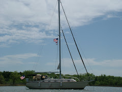
Here are some photos of this leg of the trip.
 Dismal Swamp Canal. The canal is only about 75-100 feet wide in some spots. You have to watch the depth and the height above. The depth never got less than 6.5 feet which was good for us. Had to swerve to avoid floating logs several times.
 Here is a part of the upper Pasquotank River. The canal turns at this point but you cannot see the turn until you are right on it.
 The bascule bridge just after the lock.
 This is the Dismal Swamp visitors center dock with boats rafted together.
 The water in the Dismal Swamp is very dark. It looks like dark tea. Because of this it giver off a great reflection. This photo is looking at the tree reflection in the water.
 This is the Salt Ponds inlet, photo taken from the land side looking out.
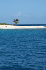
 The beach just east of the marina is very nice.
 As is the swimming pool.