We decided to continue on down the Bahama island chain to the Exumas even though the auto pilot isn't working correctly. We will probably regret it later but there are not any over nighters that we will be doing until we return back the the U.S.
We left Lucaya on the 29th of December at 7:30 AM. The winds were blowing 10-15 knots out of the east and our course is to the southeast so we wouldn't really get much sailing in. We decided to go almost straight south and take the route that goes west of the Berry Islands instead of east of them. This allowed us to sail with the east wind. We were able to sail all the way down until we had to turn southeast to go through the Northwest Channel into the tongue of the ocean on the south side of the Berry's. When we went through the Northwest Channel we couldn't find the light that guides the way until we were within about 150 feet from it. The light was not lit and it was dark and scary out. So much for the Bahamians keeping up with the navigational aids. I'm sure someone will eventually hit the post the light is on and do some major damage to their boat.
We came out of Northwest Channel at 7:30 PM and went by the west end of New Providence island around midnight. We continued southeast to a point just south of two shoaling areas and turned more east onto the great Bahama banks. We picked this area to cross the banks because there were no coral heads around to hit. The sun came up just as we got far enough east where we could head more south down the Exuma chain of islands. We ended this leg of the trip at Warderick Wells island which is part of the Exuma Land and Sea Park. We did 183 nautical miles in 29 hours hand steering all the way. Which is really exhausting by the way.
We will stay here on a mooring buoy and head 10 miles further southeast to Cambridge island tomorrow. There is great snorkeling around Cambridge and we missed it last year so we plan to stay there a week or so.
Everyone have a Happy New Year. I will write more when we have internet connectivity.
Friday, December 30, 2011
Vero Beach to the Bahamas, MON
We left Vero Beach on the 23rd of December. This was the third time we had gotten all ready to leave with two times being cancelled because the weather changed so fast. But, this time was the charm. We left the mooring field at 8:30 AM went down the ICW to the Fort Pierce inlet and headed out. Once out in the ocean we turned south to hug the coast until we got down to the Lake Worth inlet. We arrived outside the Lake Worth inlet around 6 PM and turned left to cross the Gulf Stream. The wind was around 7-9 knots from the southeast so we were motoring right into it, however the seas were only about one foot in the Gulf Stream so the crossing was a piece of cake.
We had a comfortable ride over but had to dodge several cruise ships and cargo ships around the Freeport, Grand Bahama inlet. We passed by there around 5:30 AM while it was still dark so it was a challenge watching for all the ships. We arrived outside Bell Channel, which is the entrance channel for the Grand Bahama Yacht Club where we would be staying. We decided to go to the fuel dock at Port Lucaya and get diesel fuel and check in at customs and immigration which is right there before going over and getting our slip.
We were in the slip by 10:00 AM and ready to take a nap. We didn't get a chance to nap because there were four other boats there that we knew and as boaters are they want to know all the details about the crossing.
We stayed at the marina for five nights. We had Christmas dinner on Margarita, Bill and Margaret, who we were rafted to at Vero Beach. We both supplied the goodies and dinner was great.
On the way over to the Bahamas our auto pilot decided to give us trouble again. Here, I thought we had that all behind us. Now this brand of auto pilot is rated as one of the best and I'm sure I am the only one in the world that is having problems with it. I found a mechanic that works with hydraulics and had him come take a look at it. I told him that several other mechanics had severe problems getting the lines bled. He gave it a try and actually made it worse than it was. Now we are deciding whether to continue on or come back to the states. Hand steering on over nighters is not fun at all.
We hope everyone had a Merry Christmas.
Sunday, December 4, 2011
Fernandina to Vero Beach
We stayed in Fernandina Beach for two nights. We dinghies into the marina and walked the main street. There are lots of shops to stroll around in. We also had dinner at a Mexican restaurant, the food was very good.
We departed our mooring and motored down the ICW to Jacksonville Beach where we stopped at Beach Marine. We wanted to go into a marina so we could wash all the salt off the boat. We had quite a bit of sea spray during the first eight hours of our passage south and needed to get it off before the corrosion started. We also discovered that they had a really nice laundry room so Sandy did six loads of laundry.
We left the next morning and continued down the ICW to St. Augustine. It is always a treat to visit St. Augustine. There is so much to see and do there and they have some very nice restaurants. We met some friends that also left from New Bern and did a restaurant hopping adventure. I think it was mostly for the happy hours. We stayed for three nights and then continued on.
We continued down the ICW and anchored at Rockhouse Creek for the night. Our anchor windlass still wasn't working so I used the secondary anchor which only has 30 feet of chain. I have to haul it all up by hand and it can get darn heavy. The chain weighs 40 pounds and the anchor weighs 44 pounds. The following day we traveled 63 miles and anchored in Eau Gallie. We were the only boat at this anchorage. We had gone further than other boats on the previous day. Most of them had stopped 15 miles before us at Daytona Beach. On the third day out of St. Augustine we only had a run of 35 miles to get to Vero Beach where we planned on doing some last minute provisioning to replenish what we used on the way south and to get the darn windlass fixed.
We rafted with a Canadian boat named Moxie. We met Grant and Donna and got to know them, very nice couple.
The next day I took the windlass off the deck and tore into it. I ordered some parts from Defender not knowing for sure what I might need. If I didn't need them they would become spares. After stripping the gears all apart and taking the motor off I discovered that the motor runs fine. As I would put each gear back into the gearbox I would test it. It would go both forward and backward until the final gear went in. I think I had guys from 5 different boats coming by and giving advice. I was really stumped. By this time Margareta had come in and rafted to us. We know Bill and Margaret from the marina at New Bern. It was also Thansgiving so I put the windlass aside and Sandy and I celebrated with dinner on Margareta with Bill, Margaret and Hutch and Linda from Sandcastle. We know Hutch and Linda from the marina in New Bern also. We all brought part of the dinner and it was wonderful.
I needed to call a shop that works on windlass' for some advice but everyone was closed for the holiday until Monday. I finally got ahold of Florida rigging and Hydraulics in The Palm Beach area. I explained to the technician my problem and he respond with 'Oh, that would be the compound gear'. He knew immediately why the problem was. Later that morning we rented a car and drove the 75 miles to their shop. The technician, Buck, met us at the counter and immediately grabbed the gear and confirmed the problem. The compound gear is supposed to turn a quarter of a turn in order to reverse the direction. He had a new compound gear in it by early afternoon. Sandy and I went over to the Garden Mall and had a nice lunch while it was being worked on. Well, the windlass is installed back on the boat and we are now waiting for a weather window to cross over to the Bahamas. We may have one coming up this Thursday night. In the mean time we are strolling over to the beach and just hanging with friends. We know the couples from about 12 boats that are here also waiting to cross over to the Bahamas.
Next post will hopefully be from the Bahama Islands.
Sunday, November 13, 2011
North Carolina to Florida
We left Oriental on Sunday November 5th after getting our transducer replaced. We crossed the southern part of Pamlico sound and went into Adams Creek. Adams Creek is a really nice stretch to get us down to Morehead City. The weather was not all that nice out in the ocean so we continued down the ICW to Swansboro. We were able to motor sail with 20-25 knots of wind on our starboard beam. There we stayed overnight at Caspers Marina.
The next morning we left at 0625 with four huge power boats. We had four bridges that we needed openings and two of them opened only on the hour. If you get there even a minute or so late they won't open for you and you end up waiting until the next hour opening. We lucked out and had the current with us the entire run of 45 miles. We got to all the bridges with minutes to spare.
We stayed in Wrightville Beach Monday night and on Tuesday morning met for breakfast with Island Packet 35 Island Spirit owners Hayden and Radeen and Island Packet 460 owners Eric and Pat. Hayden and I have been communicating through email for about eight years and this is the first time we have met in person.
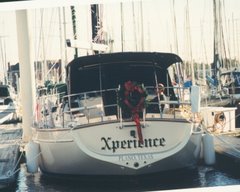
 Xperience IP380, Cutter Loose IP460
After breakfast we continued down the ICW where we anchored at Carolina Beach. We stayed here for two nights waiting for a weather opportunity to go out into the ocean at the Cape Fear river inlet. A cold front was about to move through the area so on Thursday we moved down to the Southport City Marina and get the boat prepared to leave on Friday behind the cold front. Thursday night the wind came up to 25 MPH with gusts to 35 MPH but was forecast to calm down by Friday late afternoon.
We departed the Southport marina at 1100 on Friday and headed out the Cape Fear inlet. The wind was blowing 20-25 with some higher gusts from the northwest. That put the wind on our starboard beam and gave us a really fast ride. The seas were running from 3-5 feet and were a bit confused so the ride was a little rough. Clewie did not have a good afternoon as she barfed all over the bed. Mercedes took it all in stride and rode it out in her kitty cave.
The wind did calm down some around 10 PM, a little later than forecast but we enjoyed the extra push it gave us. We passed the Charleston, SC inlet outer buoy at 0400 on Saturday morning. That was 114 miles in 17 hours.
We had to slow down quite a bit on Sunday morning so we could enter the St. Mary's inlet on the Georgia Florida border in daylight. We stopped at the Fernandina Harbor marina to get some fuel at 0800 and are now tied to a mooring buoy across the ICW from the marina. We will stay here a couple of nights and then continue down the ICW. We hope to be at Vero Beach for thanksgiving.
The next morning we left at 0625 with four huge power boats. We had four bridges that we needed openings and two of them opened only on the hour. If you get there even a minute or so late they won't open for you and you end up waiting until the next hour opening. We lucked out and had the current with us the entire run of 45 miles. We got to all the bridges with minutes to spare.
We stayed in Wrightville Beach Monday night and on Tuesday morning met for breakfast with Island Packet 35 Island Spirit owners Hayden and Radeen and Island Packet 460 owners Eric and Pat. Hayden and I have been communicating through email for about eight years and this is the first time we have met in person.

After breakfast we continued down the ICW where we anchored at Carolina Beach. We stayed here for two nights waiting for a weather opportunity to go out into the ocean at the Cape Fear river inlet. A cold front was about to move through the area so on Thursday we moved down to the Southport City Marina and get the boat prepared to leave on Friday behind the cold front. Thursday night the wind came up to 25 MPH with gusts to 35 MPH but was forecast to calm down by Friday late afternoon.
We departed the Southport marina at 1100 on Friday and headed out the Cape Fear inlet. The wind was blowing 20-25 with some higher gusts from the northwest. That put the wind on our starboard beam and gave us a really fast ride. The seas were running from 3-5 feet and were a bit confused so the ride was a little rough. Clewie did not have a good afternoon as she barfed all over the bed. Mercedes took it all in stride and rode it out in her kitty cave.
The wind did calm down some around 10 PM, a little later than forecast but we enjoyed the extra push it gave us. We passed the Charleston, SC inlet outer buoy at 0400 on Saturday morning. That was 114 miles in 17 hours.
We had to slow down quite a bit on Sunday morning so we could enter the St. Mary's inlet on the Georgia Florida border in daylight. We stopped at the Fernandina Harbor marina to get some fuel at 0800 and are now tied to a mooring buoy across the ICW from the marina. We will stay here a couple of nights and then continue down the ICW. We hope to be at Vero Beach for thanksgiving.
Friday, November 4, 2011
We have moved.
However we are now a little further north. We left New Bern on Thursday after waiting a couple of hours in the morning for the fog to dissipate. We couldn't see the channel markers that are about 100 feet off the dock.
Once it did clear out we motored down the Neuse River to Oriental, NC. We needed to stop at Deaton Yacht Service to do a short haul to replace our Airmar depth tranducer that quit working over the summer. I had ordered a new one last week and had it shipped directly to Deaton's. We were out of the water for only a couple of hours to get it replaced.
We are now sitting and waiting for the rain to pass over. Also there is forecast to have very high winds and seas for the next two to three days. Winds to 45 knots and seas running up to 20 feet. We have no business being out in that. It looks like we may leave here on Sunday or Monday and head down the intracoastal waterway to Southport and see if we get a good weather window to head out for Florida. If not we will continue down the intracoastal to either Wynah bay and exit there or go to Charleston and go out there.
Thursday, October 27, 2011
Waiting for weather
We are pretty well set to head south. We are now just waiting for a good weather window. This weekend there is a strong cold front coming through. The winds are going to be north, which is good, but could be up to 35 knots, which isn't good.
We have all of our provisions onboard. All of our bins are full and the freezer is full of meat. The aft cabin which we call the garage is full of paper products and other dry goods. We are carrying three five gallon jerry jugs of gasoline and two five gallon jerry jugs of diesel fuel. The boat has settled down to almost the top of the bottom paint line in the water. I really wouldn't want to put any more weight on the boat.
We will most likely take the same route we did last year. Go down the ICW to Southport, NC and then out the Cape Fear river inlet and do a 48 hour run to the St. Mary's inlet at Fernandina Beach, FL. Once in Florida we will most likely stay in the ICW down to Vero Beach and wait there for a good weather window to cross over to the Bahamas. We still are not sure of what route we will take to the Bahamas but we would like to go out the Lake Worth inlet at Palm Beach, FL.
There are about ten other boats here at the marina that are also about ready to head south. We all meet on the docks in the morning to discuss the weather. When we are out cruising we live by the weather.
Saturday, October 1, 2011
Reprovisioning
We have started the provisioning process for our winter cruise. We will store about 5-6 months of food and supplies on board. We have already stored $400 worth of canned goods. Next we will purchase paper products and dry goods. After that we will get the drinks, soda pop, wine, juices and powdered drink mixes. Last we will get the meat products that will go into the freezer. In all we will spend about $2000 which isn't bad for 5-6 months. There will be some fresh produce and fruit we will purchase along the way when we can find it. While in the states that isn't a problem but in the Exumas you just cannot get much good quality produce.
We are still putting the boat back together from when we had taken all of the sails and canvas off because of hurricane Irene. I have finished the maintenance on the generator and the outboard motor. We plan to leave New Bern, NC around the end of October or the beginning of November depending on weather. This year we are going to store our Expedition at a friends house about 2 miles from the marina. We will come back here next summer at least for awhile.
We are still putting the boat back together from when we had taken all of the sails and canvas off because of hurricane Irene. I have finished the maintenance on the generator and the outboard motor. We plan to leave New Bern, NC around the end of October or the beginning of November depending on weather. This year we are going to store our Expedition at a friends house about 2 miles from the marina. We will come back here next summer at least for awhile.
Saturday, September 17, 2011
KF5MMB
Kilo Foxtrot Five Mike Mike Bravo
This is my new HAM radio call sign. I have been studying this summer to get my HAM radio license. I passed the technician test in August and passed the general test in September. I added a Pactor modem to our onboard SSB, Single Side Band, radio so we can now send and receive emails over the HF, high frequency, airwaves and also download more and better weather data. With the HAM license I can use frequencies that will allow me to do this anywhere in the world.
This is my new HAM radio call sign. I have been studying this summer to get my HAM radio license. I passed the technician test in August and passed the general test in September. I added a Pactor modem to our onboard SSB, Single Side Band, radio so we can now send and receive emails over the HF, high frequency, airwaves and also download more and better weather data. With the HAM license I can use frequencies that will allow me to do this anywhere in the world.
Tuesday, August 30, 2011
Hurricane Irene
We weathered the storm at Northwest Creek marina. It is just down the Neuse river from New Bern North Carolina. The marina has a good hurricane plan, that is one reason we decided to spend the summer here.
Xperience had no damage to her. Some boats had minor cosmetic damage and there was some minor dock damage. The biggest headache will be all the cleanup. We drove around the area and there are dozens of trees down just in this neighborhood. Some are on top of homes. Some area have there power back on but not the marina. We most likely won't have power for another 3-4 days. We moved back onto the boat on Sunday. Here we can cook with our propane stove and we have solar panels that can keep our batteries charged to run the refrigeration, lights and pumps. There is fresh water on the docks.
Here is a link to photos taken prior to, during and after the storm.
 |
| Hurricane Irene 08/27/2011 |
Friday, June 17, 2011
Just Hangin'
We are just hanging around and doing some boat work at Northwest Creek marina near New Bern, North Carolina.
We were able to get four coats of Cetol on our exterior teak. We cleaned it up real good and put two coats of Cetol Natural Teak which has a little bit of color in it, and also two coats of the Cetol clear gloss. You wouldn't believe how the salt water corrodes the stainless steel. We used Collinite metal wax to go over all of our stainless steel to bring it back to its shiny glory. It took lots of rags and a couple of toothbrushes to get into all of the little nooks and crannies.
We have met many nice people that have there boats in slips next to us. Some we knew from the Bahamas. There are about 6 couples staying here that we met in the Exumas. A few of them have homes nearby.
We rented a car and drove up to Hampton to pick up our Expedition. It is good to have ground transportation. We have gone around the city of New Bern and are learning where things are, especially the good restaurants. Eventually we will travel out a little further. Next week we plan on going up to Raleigh. It is about a two hour drive from here.
We have several more boat projects to do and we need some more spare parts for the next cruising season so we will be working on that stuff. There is always something to do on the boat.
Thursday, April 28, 2011
Now in North Carolina
We departed Fernandina, Florida on Wednesday the 13th of April. We had a good weather window for about 66 hours and it would take us about 50 hours to reach the Southport marina. We knew we could duck into either Charleston or Georgetown if need be.
When we were going out the St. Mary's inlet we saw "Margareta" IP445 with Bill and Margaret heading out also. We met them at Long Island in the Bahamas in January. They are from North Carolina and keep there boat at Northwest Creek Marina. I hailed them on the radio and Bill told me they were going to go in at Charleston. We decided to set up radio contact every three hours for the overnight passage.
Margareta stayed closer to shore and we did the rhumb line route so we were about 20 miles further out to sea. During the night Margareta kept getting further ahead of us. Bill said that they had a two knot current helping with their speed. The first night passage was relatively mild and we had to motor sail most of the way. Margareta passed the Charleston inlet around 6 AM so they decided to continue further up to Georgetown. We passed the inlet around 9 AM. We were right on our scheduled time. We didn't want to get up to the Cape Fear river before daylight the next morning.
The second night out the seas got really sloppy for about 6 hours and it cut our speed way down. We had 2-3 foot waves on the bow. I had checked the weather forecast and it showed that the wind and waves were supposed to back to the southeast later in the day. Sure enough it did and we were back up to our cruising speed with an estimated time to arrive at the Cape Fear river at 5 AM. Sunrise was at 6:48 AM that day so we had to heave to for about an hour and a half to wait for it to get light enough to see the channel buoys. The current was to be slack at 6:58 AM and then start ebbing which would be against. I wanted to get into the inlet as soon as we could. As it turned out the speed of the ebb was faster than us. By the time we got just past Bald Head Island we had a two knot current against us. Also the wind had picked up out of the southest to 15-20 knots.
We were able to reserve a slip at the Southport Marina for a few days. There was some really bad weather with predicted tornadoes heading our way. It did arrive on Saturday night and was as bad as they predicted.
We left Southport on Monday and just went up to Wrightsville Beach. We had a great current going with us and the 27 mile trip only took us a little over 3 hours. We stayed in Wrightsville Beach one night. We left at 6:30AM with a good current and was able to time it so we made all four of the bridge openings between Wrightsville Beach and Swansboro at our planned time. We stayed at Swansboro for one night. Margareta had caught up to us and were tied up at Caspers Marina next to us that night. The next morning we left Swansboro at 6:45 AM and made it up to Whitaker Pointe Marina by 1:30 PM. We stayed there for six nights until we could get in at Deaton's Boat Yard for service. We will stay here until the service items are taken care of and then head up the Neuse River to the Northwest Creek Marina. We will be staying there for an extended period of time. We are going to go up to Hampton, VA to pick up our Expedition and bring it back so we will have ground transportation.
All in all it was a good sailing winter. We saw and experienced a lot of new things and met some wonderful people. It is going to be nice to just sit still for awhile though. I am looking forward to sleeping in and not having to get up at 6:00 AM to listen to the weather every morning. Hey, maybe I will stay up past 9:00 PM now.
Wednesday, April 6, 2011
Moving north
While at Vero Beach we rented a car and went to Walmart to restock. We also went to the Publix grocery store to get fresh meat and produce. Every Saturday there is a farmers market over by the beach. We went over and bought some grapefruit and oranges and they are excellent.
After being at Vero for a couple of days "Song of Pogo" came in. This is the sailboat with Otis and Marty from Annapolis. We met them last year at the Dismal Swamp Canal visitors center and had been in anchorages and marinas with them all the way to Vero Beach on our way south. They had crossed over to the Bahamas on the same night we did in December. They went and stayed in the Abacos while we went further south. We also ran into "My Time Two" with Charlie onboard. We last saw him at Vero in December. He went to Ft. Myers on the west side of Florida for the winter.
We stayed at Vero Beach for eight nights and then left with "Song of Pogo" heading north. The first night we anchored overnight off the ICW at Eau Gallie. The next morning we left and went up to Titusville. "Song of Pogo" is going to stay at the Titusville marina for a month while Otis and Marty go care for his 91 year old father. We stayed for four nights at the marina to allow a really strong line of storms pass over. One night we had wind gusts to 50 knots with a whole lot of rain which was needed badly in this area. The was the first time we had been in the Titusville marina and it is very nice. There are over 40 manatees that hang out in the marina area. At night you can hear them rubbing up against the hull. We have seen more manatees in the ICW this trip than all of last year.
After the storms passed we left Titusville and headed for St. Augustine. We anchored overnight at Daytona. There is an area off the ICW just west of marker red 44 that shows on the chart at 13-15 feet. In reality it is only 5 - 7 feet. There were quite a few boats there and we were able to find a spot in 7 feet of water where we were out of the channel. Lots of boats going by on the ICW made the place very rolly. At least after dark it did smooth out when traffic died down. The next day we went up to St. Augustine where we are now on mooring M32 on the south side of the Bridge of Lions. We will stay here about a week and then continue up the ICW to Fernandina. We want to also go back to Cumberland Island and do some day hiking. Once we have a good weather window we plan to go out St. Mary's inlet and head to either Cape Fear or Beaufort, North Carolina. We will then be staying in the New Bern/Oriental area for awhile.
Sunday, March 20, 2011
Back in the U.S. of A.
We saw that the weather window for crossing the Gulf Stream was going to be good on Wednesday the 16th of March so we hustled our little butts and got ourselves in position to go.
From Black Point we went north to Sampson Cay to refuel. Sampson Cay has a nice little marina in a protected cove. We just went in for fuel and to buy a few groceries. While we were getting fuel we met Juan and Astella aboard 'Far Away' from Annapolis. They were also heading back to the states. They were going to Key Biscayne and Miami and we were going further north to Lake Worth, Palm Beach area. We both had to get to New Providence Island first however. Us to the east end and Nassau and them to the west end and West Bay.
We sailed with them north up to Hawksbill Cay which is one of the islands in the Exuma Park. We were able to pick up a mooring just off the beach. There were only three boats there for the night. Sandy and I went into the beach and scouted around for a couple of hours. On the way back to the boat Juan hailed us to come by and invited us over for dinner that night. Sounded great to me, I wouldn't have to cook.
Astella had made a really nice chicken dish and eggplant and cheese dish. We enjoyed dinner and talking about our travels and stayed until 9 PM. In the cruising mode 9 PM is an hour after midnight. They were getting up early the next morning and heading to West Bay which at the west end of New Providence Island, about 60 miles away. We were just going up to Allen's Cay which is north about 20 miles.
The next morning when we got up we noticed that Far Away had not left and daylight was wasting. Sixty miles is a long way to go during the day. They finally got under way about 8:30. I talked to them on the radio as they were leaving and Juan told me he had to put on a new alternator belt on the engine. Just the night before we were talking about how there is always three things broke on the boat. At the time Juan had only two items in need of repair. He didn't see that one coming.
We made it up to Allen's Cay without incident, after I checked our alternator belt of course. We anchored there for one night and then headed for Nassau in the morning.
To get to Nassau from Allen's Cay we had to cross the Yellow Banks. It is an area of coral heads and shallow water. The skies were partly cloudy and at times the clouds would block how well we could read the water. When we got to the area where the Yellow Banks starts the clouds just kind of parted to let the sun come through. It was like a divine intervention. God looks after fools and sailors. Oh wait, they are one in the same, at least in our case. We were able to pick out the coral heads fine and made it into Nassau fine.
We went into the Nassau Yacht Harbor marina. Now it never fails that when we go into a marina we get put into the tightest spot they have and this was no exception. We were put into the slip at the inside end of the dock where there is no room to maneuver to get out. And on top of that they put a huge catamaran on the face dock behind us. The current flows through Nassau at 2-3 knots so getting out will be quite interesting and we have to leave at first light in the morning.
Come morning, we end up having to wait until 8:00 for the marina office to open in order to check out. Waiting a bit actually helped our departure as the current was slackening and the wind was rather calm. We were able to back straight and as we were approaching the catamaran behind us I could see a woman sitting in the salon and her eyes were getting larger and larger as we got closer. I stopped the aft motion with about two inches to spare and made the forward turn to clear the pilings. A good start to a 30 hour run to the Lake Worth inlet.
Our first leg of the trip would take us north to the northern end of the Berry Islands and then we would turn northwest for Florida. The wind was blowing from the east-southeast around 15-17 knots and we were sailing 7-8 knots. When we turned northwest the wind calmed some, plus the affect of sailing downwind so we were not able to move quite as fast. We definitely wanted to reach the inlet in daylight so we had to motor sail for while to keep our speed up. We did our usual dodging of cruise and cargo ships during the night, especially around the Freeport, Grand Bahama Island area. I was able to watch fireworks at midnight which were being shot from one cruise ship.
We reached the outer buoy at Lake Worth at 1:30 PM on Wednesday after a non-eventful crossing of the Gulf Stream. We were immediately greeted by the Customs and Border Patrol boat which asked there usual questions. We gave the appropriate yes and no answers.
Once in the inlet it was like a shock to the system having so many other boaters around. They were everywhere, on a Wednesday. Don't people work anymore? We went north in the ICW up to North Lake Worth and set the anchor. Thirty-one hours Nassau to Lake Worth. We called into the Customs office and they told us we had 24 hours to come in so they could see us. Even though they took all of our information over the phone they wanted to see out cute faces.
To get to the customs office we had to unload the dinghy, put the outboard on it, dinghy into a small beach, climb up a hill and over a bridge barricade, walk a half mile to the bus stop, wait 45 minutes to catch the 21 bus, go two miles and change to the 1 bus, go four miles to the 12th street stop and walk two blocks to the customs office. The customs officer took our passports, looked at us and that was it. Then we had to reverse the whole process to get back to the boat. At least the 'entertainment' on the bus was priceless.
Since we purchased an all day bus pass we decided to go the the Gardens Mall in North Palm Beach. Again this was a shock to our systems. We hadn't been with this many people or seen so much stuff in a long time. But, we got used to it real quick.
The next morning we headed up the ICW to Jensen Beach for the night. We just stayed one night there and are now at Vero Beach where we will stay for a week or so. It needs to warm up some up north before we go to much further. We actually had to put the blanket back on the bed. The lows at night in the Exumas was 70-72, here it is in the mid 50's to 60, burrrr.
Friday, March 18, 2011
Some more photos
Here are some more photos and a few short video clips.
Calabash Bay, north end of Long Island.

Calabash Bay anchorage.
This is Kumbaya with Jerry and Barb sailing to Conception Island with us.

Lee Stocking Island.
 Looking north out onto the Exuma Sound.
 Looking south onto the Exuma Banks side.
 Looking south onto Exuma Sound.
Starfish at Lee Stocking Island, Coconut Beach.


Long Island, Thompson Bay anchorage.
Wednesday, March 9, 2011
Heading Back North
Since I last wrote we have toured Long Island by car, left Thompson Bay, Long Island and went back to Conception Island. Went from Conception Island to Georgetown, Great Exuma, went up to Lee Stocking Island, went further north to Jack's Bay, Great Guana Cay and are now at Black Point, Great Guana Cay.
While at Long Island we rented a car with Jerry and Barb on the sailing vessel Kumbaya and toured the island. First we went to Dean's Blue Hole. This is a deep hole just off the shore. It is the deepest known blue hole in the world. The depth is 663 feet and the world record free diver trains here. I believe the record free dive is 302 feet. I made it down about 20 feet before my head felt like it was going to explode.
We were able to snorkel around the hold and out onto some coral reefs where the ocean comes into the cove. Lots of fish and sand dollars.
 Dean's Blue Hole
 Dean's Blue Hole

 St. Mary's Church in Clarencetown, Long Island.
We left Thompson Bay and went back to Conception Island after an overnight stop at Calabash Bay, Long Island. On the way into Calabash Bay we saw two whales breach about 200 yards from the boat. We later found out that they are Brides whales. They are called that because when they blow the water out of their blow holes it looks like a brides veil. It was very cool to see them. We didn't go ashore since we had already done that on our previous stop here.
We left early the next morning for Conception and got in after about a 4 hour trip. The sail over was very nice with wind about 15-18 knots off the beam and seas about 3-4 feet. After anchoring we went ashore and went over to the ocean side of the island to snorkel the reef and a wrecked boat. We saw lots of fish there also. We hung out on the beach and did some swimming in the cool waters.
We left after staying three nights and started our trek back north. Our first stop was back in Georgetown. The annual regatta was going on so there were over 300 boats anchored in the area. We found a spot just off Monument beach for the night.
The next morning we departed for the 25 mile sail up to Lee Stocking Island. There was a cold front approaching and we wanted to get anchored before it reached us. Well it moved faster than was predicted and about 5 miles out of the anchorage the winds built to around 20 and the seas came up to 4-5 feet. We had to go thru Adderley cut to get back to the anchorage and the cuts are famous for being treacherous in bad weather. When we got to the cut the tide was going in on the flood, which I planned our arrival for, so the wind and current were going the same direction. This keeps the seas at the cut from building to dangerous levels. We started into the cut just and it started to rain. We turned around to wait out the rain. We have been in a rain shower before where we couldn't see the bow of the boat. The rain didn't get that heavy this time and after waiting about 10 minutes we made it into the cut and picked up a mooring at the Caribbean Research Center. We stayed five nights there waiting out bad weather. While there we went over to Coconut Beach and snorkeled and climbed Perry's Peak which is the highest spot in the Exuma's at 123 feet.
 View from Perry's Peak


 Tug and barge rocks.
We finally got a good weather window and headed back out Adderley Cut into Exuma Sound (Ocean side) and went north 12 miles to Cave Cay cut. Cave Cay cut was an easy entry to cross from the sound to the banks. Once on the bank side we headed north another 15 miles to Jack's Bay, Great Guana Cay.
We stayed at Jack's Bay for two nights. We were the only boat there and the winds were light and the sky clear. At night we could see thousands of stars with no lights around for miles. Since we were alone we decided to take our showers outside on the transom. We had hot water, warm temperatures and light wind, which all make for a pleasant outdoor shower. Here I am all soaped up, butt naked on the stern with life at its zenith when the water pressure dies. Yep, the fresh water pump decided to give it up. After 10 years I guess it was time. Well, I had to go below and fill a bucket with fresh water using the hand pump in order to rinse off. Just when you think all is well the boat hiccups. Luckily we carry a spare pump and I had it changed in about 30 minutes. I about have to stand on my head to change it and when I was done I needed another shower so it got a good test.
We are now anchored at Black Point where we will do laundry before heading further north. It is hard to believe but we are actually getting homesick from the good old USA. We are pretty sure we will now head back over to Florida. We will still go slow and make stops but it is time to return.
I still have some short videos of our anchorages to upload but just can't get the bandwidth to do it over here. Eventually I will when we get back to the states.
While at Long Island we rented a car with Jerry and Barb on the sailing vessel Kumbaya and toured the island. First we went to Dean's Blue Hole. This is a deep hole just off the shore. It is the deepest known blue hole in the world. The depth is 663 feet and the world record free diver trains here. I believe the record free dive is 302 feet. I made it down about 20 feet before my head felt like it was going to explode.
We were able to snorkel around the hold and out onto some coral reefs where the ocean comes into the cove. Lots of fish and sand dollars.
 Dean's Blue Hole
 Dean's Blue Hole
 St. Mary's Church in Clarencetown, Long Island.
We left Thompson Bay and went back to Conception Island after an overnight stop at Calabash Bay, Long Island. On the way into Calabash Bay we saw two whales breach about 200 yards from the boat. We later found out that they are Brides whales. They are called that because when they blow the water out of their blow holes it looks like a brides veil. It was very cool to see them. We didn't go ashore since we had already done that on our previous stop here.
We left early the next morning for Conception and got in after about a 4 hour trip. The sail over was very nice with wind about 15-18 knots off the beam and seas about 3-4 feet. After anchoring we went ashore and went over to the ocean side of the island to snorkel the reef and a wrecked boat. We saw lots of fish there also. We hung out on the beach and did some swimming in the cool waters.
We left after staying three nights and started our trek back north. Our first stop was back in Georgetown. The annual regatta was going on so there were over 300 boats anchored in the area. We found a spot just off Monument beach for the night.
The next morning we departed for the 25 mile sail up to Lee Stocking Island. There was a cold front approaching and we wanted to get anchored before it reached us. Well it moved faster than was predicted and about 5 miles out of the anchorage the winds built to around 20 and the seas came up to 4-5 feet. We had to go thru Adderley cut to get back to the anchorage and the cuts are famous for being treacherous in bad weather. When we got to the cut the tide was going in on the flood, which I planned our arrival for, so the wind and current were going the same direction. This keeps the seas at the cut from building to dangerous levels. We started into the cut just and it started to rain. We turned around to wait out the rain. We have been in a rain shower before where we couldn't see the bow of the boat. The rain didn't get that heavy this time and after waiting about 10 minutes we made it into the cut and picked up a mooring at the Caribbean Research Center. We stayed five nights there waiting out bad weather. While there we went over to Coconut Beach and snorkeled and climbed Perry's Peak which is the highest spot in the Exuma's at 123 feet.
 View from Perry's Peak


 Tug and barge rocks.
We finally got a good weather window and headed back out Adderley Cut into Exuma Sound (Ocean side) and went north 12 miles to Cave Cay cut. Cave Cay cut was an easy entry to cross from the sound to the banks. Once on the bank side we headed north another 15 miles to Jack's Bay, Great Guana Cay.
We stayed at Jack's Bay for two nights. We were the only boat there and the winds were light and the sky clear. At night we could see thousands of stars with no lights around for miles. Since we were alone we decided to take our showers outside on the transom. We had hot water, warm temperatures and light wind, which all make for a pleasant outdoor shower. Here I am all soaped up, butt naked on the stern with life at its zenith when the water pressure dies. Yep, the fresh water pump decided to give it up. After 10 years I guess it was time. Well, I had to go below and fill a bucket with fresh water using the hand pump in order to rinse off. Just when you think all is well the boat hiccups. Luckily we carry a spare pump and I had it changed in about 30 minutes. I about have to stand on my head to change it and when I was done I needed another shower so it got a good test.
We are now anchored at Black Point where we will do laundry before heading further north. It is hard to believe but we are actually getting homesick from the good old USA. We are pretty sure we will now head back over to Florida. We will still go slow and make stops but it is time to return.
I still have some short videos of our anchorages to upload but just can't get the bandwidth to do it over here. Eventually I will when we get back to the states.
Tuesday, February 8, 2011
Beyond Georgetown
We departed Georgetown and headed further southeast to Thompson Bay, Long Island. The distance was about 33 miles over the Great Exuma Banks in water that ranged from 20 to 8 feet. We could see the bottom, which was mostly just sand as though we were looking down in a swimming pool. The trip took us about 5 hours. There wasn't much wind and we had to motor sail the entire way. This was the first good weather window in a week and there were about 20 boats heading this way.
When we arrived at the Thompson Bay area we went first to the Long Island Petroleum dock to fill us with diesel fuel. This was the first time we had gotten fuel since we were in Spanish Wells at Christmas time. The water is only 5 feet at the dock at low tide and when we arrived the tide was about mid way on a rise so we had about 7 feet. It was also pretty calm so it was an easy in and out. We did have to wait for two other boats in front of us to fuel so we just hung out in the bay for a bit. Anchored in the bay was the Island Packet 380 Tides Inn. There boat is hull number 132 and ours is 133 so they came out of the factory about a month apart. I had emailed Mark and Susan numerous times through the Island Packet email list serve. We motored by close to say hello as they were out on deck and curious who we were. After refueling we went over the the other part of the bay and anchored amongst 30 other boats.
Salt Pond is the settlement at Thompson Bay. It is a great location for going to the grocery store, getting connected to the web and doing laundry. We have done all of those things several times now. The only down side to the bay is that it is very silty and we don't want to run our watermaker here.
On Tuesday February 1st we left and headed north up the banks side, (west), of Long Island. Our destination was Calabash Bay which we planned to stop in for a night on our way to Conception Island. This leg of the trip was only 22 miles and it only took us about 3.5 hours. Calabash Bay is pretty much open all around with protection from winds and seas from only the northeast to southeast. Since it is pretty close to the northern most end of the island the ocean swell will come around the corner and rock the boat. There is a beautiful two mile long beach there with a small resort on it. We went to the beach to walk around and look for shells. There were only 5 other people on the entire beach.
The next morning we departed Calabash Bay and headed around the northern end of Long Island into the Atlantic Ocean. The name of this land area is Cape Santa Maria. It is named after the flag ship of Christopher Columbus who landed in this area and his boat went aground there. He should have had a Garmin chartplotter, what was he thinking?
It is pretty amazing when we go from the banks to the ocean. The water depth goes from 6-8 feet to 6000 feet in a matter of a mile or so. The ocean part of this leg was about 17 miles. The seas were not real high but they were confused and the ride was somewhat uncomfortable. Three hours after getting into the ocean we pulled into West Bay at Conception Island. To get into the bay we had to go between two reefs which didn't pose a problem. We could see them on our chartplotter and with the sun behind us they were clearly visible.
There were 5 other boats there and lo and behold one of them was Destiny with Jimmie and Bess onboard. We met them in the Dismal Swamp in November and did the 50 hour passage from North Carolina to Florida with them. We hadn't seen them since Vero Beach.
We spent some time hiking on the island and checking out the numerous beaches on both sides. We also took our dinghy with Jimmie and Bess into the mangrove swamps at high tide to see the sea turtles. We saw 30 or 40 of them and when you approach they take off like a rocket to get away. I wouldn't have believed how fast they can swim if I wouldn't have seen it with my own eyes.
We stayed three nights at Conception Island and then returned to Thompson Bay doing the 43 mile run in one shot. We wanted to get back to where it is protected before the next front came through. Conception Island has no protection from south to west to north winds.
We are now at Thompson Bay making plans for our next excursion from here.
Here are some photos of Conception Island. Don't forget you can click on a photo to get the larger version.


Monday, January 24, 2011
Some Photos
Norman's Cay.


Shroud Cay, Exuma Land and Sea Park.
Warderick Wells, Exuma Land and Sea Park.


Shroud Cay, Exuma Land and Sea Park.
Warderick Wells, Exuma Land and Sea Park.


Warderick Wells to Georgetown
We departed the Exuma Land and Sea Park mooring in Warderick Wells with a nice east wind
blowing about 12 knots. We headed southeast for the island of Big Majors Spot. There isn't
anything on Big Majors Spot to speak of but it is a great anchorage very near Staniel Cay
which has a settlement.
The big attraction at Big Majors Spot are the feral pigs that beg for food from the boaters.
They hang out on the beach and when a dingy comes by they will swim out to beg for food.
If they are in the trees behind the beach and a dingy goes by they will come a runnin'.
They really swim pretty good and will go into water that is pretty deep.
Staniel Cay has a settlement and the gathering place is the Staniel Cay Yacht Club. It is a
small marina that has a restaurant and bar. We had dinner there one night and watched one
of the NFL playoff games on there three big screen TV's. Sandy and I each had a rum punch.
They cost nine dollars for a eight ounce glass. Talk about steep!
We hung out in the anchorage for four days and went to the small grocery. The food prices
are about triple what we would pay in the states. We also purchased a cell phone to use
while in the Bahamas. The price for it was about the same as the states. I tried to refill
my propane tank but they ran out and I would have to wait until the next week for the fuel
boat to come in. I will try the next island.
There is a snorkeling site just off of Staniel Cay called Thunderball Cave. This is where
the underwater scenes in the James Bond movie Thunderball were filmed. We didn't go
snorkeling there because the current was flowing strong and the tide was rising. You cannot
get into the cave at high tide without diving under. We will try it on the way back north.
From Big Majors Spot we went south on a windless day to Black Point on the island of Guana
Cay. Black Point is the largest settlement in the Exumas with the exception of Georgetown.
We stopped here mainly to do laundry. Black Point has the best laundry facilities in the
Exumas. It was $2.75 for a wash and $2.75 for a dry and we were glad to have it. Just down
the street from the laundromat is Lorraine's Cafe. It is a small restaurant with an
internet room. We were able to check our emails and let my brother and sister-in-law know
where we were and that we were still floating.
The boat Chanticleer was in the anchorage both at Big Majors Spot and Black Point. We went
on a hike and had drinks with Steve and Roberta before going to dinner at Lorraine's. We
happen to hit happy hour at Scorpions Bar and the drinks were two for one. Wow, two rum
punches for nine dollars. The cruising guide lists Scorpions as the place to be. There
were about 7 people there including the four of us. I guess the guide needs updating. Our
dinner at Lorrain's was barbecue. Now coming from Texas where barbecue is king I really
wasn't expecting much from Lorrain's, and I was right. It was good, but not great. They
serve it from the kitchen and each plate didn't even have the same things on them. A couple
of plates had corn on the cob and others had cole slaw, all had ribs and chicken though. We
are not complaining mind you, it is just different and that is why we came over here, to be
different, and it was only $15 a plate, a real bargain down here.
A cold front was coming through with winds forecast to be in the 20 to 30 range. We decided
to stay put and ride it out. Chanticleer moved on south. We had a couple of rolly nights
but nothing too uncomfortable. There were about 25 boats in the anchorage.
After eight days at Black Point we decided to head for Lee Stocking Island about 30 miles
southeast. We had planned on leaving the banks side of the Exumas and go into the sound at
Dotham Cut which is just around the point from the Black Point anchorage. We left early and
when we got to the cut we could see breaking waves accross it and did not like what we saw.
We turned around and headed down the banks side to Little Farmers Cay and the cut there.
Just as we got back near the anchorage a fog rolled in and shrouded the entire area. We
could only see about 50 feet. Our Garmin chartplotter and radar showed us the way and the
fog lifted about eight miles south. We came around the Little Farmers Cay from the south
and went straight out of Farmers Cut into Exuma Sound. The cut had some waves which buried
our bow and gave us quite a ride for about 5 minutes. Once out of the cut everything
smoothed down. The banks side of the Exumas usually runs from 8 to 25 feet in depth. Once
on the sound side the depth dropped sharply to over 1500 feet. From Farmers Cut to the cut
at Lee Stocking Island took us about 3 hours. Going into the Lee Stocking Island cut was
very calm with just a few 1 foot swells.
When we pulled around the island to the anchorage Chanticleer was there as was the catamaran
Ajaya, Ajaya had rafted to us at the Dismal Swamp Canal in North Carolina last October.
That evening we had wine and cheese on Chanticleer with Phil and Nikki from Ajaya. The next
day Steve, Roberta, Sandy and I went exploring on the island and hung out at a secluded
beach where the water was clear as a tub and nice and warm. We first climbed Perry Peak
which is the tallest hill in the Exuma's. It is 39 meters high. It took a whole five
minutes to get up it but the views were gorgeous. Later we swam and waded in the bay off
the beach. We were finding a bunch of sand dollars, huge red and gold starfish and conchs.
We left them all where we found them because this is a protected area. A marine research
center is on the island and gives tours but not on the days we were there. Something else
to do on the way back. This is the first time we saw several sharks since being in the
Bahamas. We believe they were nurse sharks which are not supposed to be aggressive to
humans. I wasn't about to go interview them though. We had a full moon overnight and you
could see the bottom. We were anchored in about 6-7 feet. The water was so calm it looked
like we were floating in air.
After two nights we left to head to Georgetown since there was another cold front coming and
a wind shift to the west. Georgetown offers much more protection from west winds. The
forecast was for the winds to clock around from the east to south, west and back north and
east with the passage of the front. Squalls are predicted with gusts to 35 knots.
It took us about four hours to get to Georgetown. We anchored off of Sand Dollar beach to
the east of Georgetown off of Stocking Island. Yep, you heard that right, this is Stocking
Island without the Lee. We dinghyed the mile across the harbor to go into town to get some
groceries and scout out the situation. The wind had picked up and it was a choppy ride
across. To go into Georgetown you take your dinghy into Lake Victoria. It is a small lake
that is accessed by going under a bridge that is about eight feet high and so narrow that
only one dinghy can fit through it at a time. The incoming dinghys have right of way do to
the fact that there is a swell pushing you into the opening. It would be very easy to crash
into the walls going under the bridge.
We will be in Georgetown for about a week reprovisioning and doing a few boat maintenance
chores. We plan on going over to Long Island and Conception Island from here. Then maybe
down into the Jumentos Cays.
Wednesday, January 5, 2011
Spanish Wells to Warderick Wells
We refueled and left Spanish Wells on Tuesday December 28th. We left around noon in order to time our arrival at Current Cut around slack tide. This is a cut between the sound at the northern end of Eluthera and the southern part of Eleuthera. As the name implies there can be a severe current flowing through the cut. While doing some research on it I found some web sites that claim that this is the best drift dive for scuba divers in the world. At times the current can get up to 10 knots. Our boat won't even go that fast so it would be impossible and dangerous to try to go through when there is a strong current flowing. We arrived at the cut around high tide and went right into the cut having the current flowing with us at between one half and one knot. As we came out of the cut we had to make a ninety degree turn to the right into a narrow channel. If the current is flowing to fast it can carry the boat right into the shallows.
About a mile past the cut on the south side of Current Island we anchored for the night. The weather was calm and in the mid 60's overnight with clear skies. It was so dark we could see stars right down to the horizon. There was only one other boat near us.
On Wednesday we left early for the 40 miles to get to Allen's Cay in the northern Exuma island chain. We made good time and pulled into the anchorage around 3:00 in the afternoon. As soon as we got anchored Steve and Roberta from Chanticleer dinghyed over to us. They are the boat we were rafted up to in Vero Beach. They had arrived from Nassau about 30 minutes before we arrived.
We only stayed at Allen's Cay for one night. On Thursday we headed down to Norman's Cay which was only about a 14 mile sail. Chanticleer was right on our stern as we made the sail. We both pulled into the anchorage at Norman's around noon. We stayed at Norman's for four nights. During our visit we hiked on the island and did some beach combing to look for shells. We also snorkeled the nearby reef which didn't really have that much sea life. I was particularly looking for lobsters to catch. We were able to see fireworks on New Year's Eve from an island to the southeast of us. There isn't any settlement at Norman's and not much really going on.
We departed Norman's on Monday the 3rd of January and motored the 6 miles southeast to Shroud Cay. This is the start of the Exuma Land and Sea Park which extends to the southeast another 20 miles or so. After anchoring we took the dinghy and explored the northern end of the island. We went to one of the beaches and walked on the sand and in the shallows. We found several conch but had to put them back. The park does not allow any taking of fish, shellfish or lobsters.
We just stayed one night at Shroud Cay and then had a nice sail 18 miles down to Warderick Wells. We were able to get a mooring buoy in the north mooring field. There is a cold front coming in with winds predicted to be 25-30 knots from the west and northwest. This is a good protected spot and the moorings were filling fast.
We took a hike to Boo Boo hill and beach and went to some blow holes on the ocean side of the island. It is called Boo Boo hill because it is supposed to be haunted from a ship wreck in the 18th century. Very scenic area with many different colors of the water. I have some great photos but won't be able to get them uploaded until we have a faster internet connection. We also have one of the better snorkel sites just 100 yards from the boat. We have already snorkeled there several times. There are numerous varieties of fish and some huge lobsters. The water is still a little chilly so we have to wear our wet suits when we snorkel.
We will be here until after the cold front passes through and then continue moving southeast.
Subscribe to:
Posts (Atom)