When we arrived at the Thompson Bay area we went first to the Long Island Petroleum dock to fill us with diesel fuel. This was the first time we had gotten fuel since we were in Spanish Wells at Christmas time. The water is only 5 feet at the dock at low tide and when we arrived the tide was about mid way on a rise so we had about 7 feet. It was also pretty calm so it was an easy in and out. We did have to wait for two other boats in front of us to fuel so we just hung out in the bay for a bit. Anchored in the bay was the Island Packet 380 Tides Inn. There boat is hull number 132 and ours is 133 so they came out of the factory about a month apart. I had emailed Mark and Susan numerous times through the Island Packet email list serve. We motored by close to say hello as they were out on deck and curious who we were. After refueling we went over the the other part of the bay and anchored amongst 30 other boats.
Salt Pond is the settlement at Thompson Bay. It is a great location for going to the grocery store, getting connected to the web and doing laundry. We have done all of those things several times now. The only down side to the bay is that it is very silty and we don't want to run our watermaker here.
On Tuesday February 1st we left and headed north up the banks side, (west), of Long Island. Our destination was Calabash Bay which we planned to stop in for a night on our way to Conception Island. This leg of the trip was only 22 miles and it only took us about 3.5 hours. Calabash Bay is pretty much open all around with protection from winds and seas from only the northeast to southeast. Since it is pretty close to the northern most end of the island the ocean swell will come around the corner and rock the boat. There is a beautiful two mile long beach there with a small resort on it. We went to the beach to walk around and look for shells. There were only 5 other people on the entire beach.
The next morning we departed Calabash Bay and headed around the northern end of Long Island into the Atlantic Ocean. The name of this land area is Cape Santa Maria. It is named after the flag ship of Christopher Columbus who landed in this area and his boat went aground there. He should have had a Garmin chartplotter, what was he thinking?
It is pretty amazing when we go from the banks to the ocean. The water depth goes from 6-8 feet to 6000 feet in a matter of a mile or so. The ocean part of this leg was about 17 miles. The seas were not real high but they were confused and the ride was somewhat uncomfortable. Three hours after getting into the ocean we pulled into West Bay at Conception Island. To get into the bay we had to go between two reefs which didn't pose a problem. We could see them on our chartplotter and with the sun behind us they were clearly visible.
There were 5 other boats there and lo and behold one of them was Destiny with Jimmie and Bess onboard. We met them in the Dismal Swamp in November and did the 50 hour passage from North Carolina to Florida with them. We hadn't seen them since Vero Beach.
We spent some time hiking on the island and checking out the numerous beaches on both sides. We also took our dinghy with Jimmie and Bess into the mangrove swamps at high tide to see the sea turtles. We saw 30 or 40 of them and when you approach they take off like a rocket to get away. I wouldn't have believed how fast they can swim if I wouldn't have seen it with my own eyes.
We stayed three nights at Conception Island and then returned to Thompson Bay doing the 43 mile run in one shot. We wanted to get back to where it is protected before the next front came through. Conception Island has no protection from south to west to north winds.
We are now at Thompson Bay making plans for our next excursion from here.
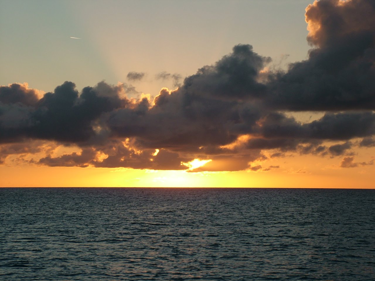
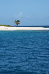
Here are some photos of Conception Island. Don't forget you can click on a photo to get the larger version.